Area Overview for BS5 0TW
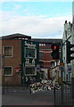
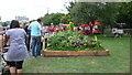
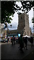
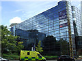
Photos of BS5 0TW

Area Information
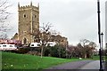
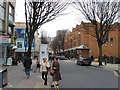
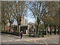
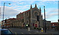
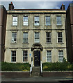
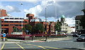
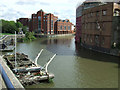
BS5 0TW lies in the St Jude’s neighbourhood of central Bristol, a postcode on Eugene Street bounded by the M32 motorway, Stapleton Road, and Easton Way. This area sits in the lower Frome valley, between the River Avon and River Frome, just east of the city centre. Historically known as Poyntz Pool and the Lamb Ground, St Jude’s evolved from a 17th-century settlement into a densely populated Victorian district. By the 20th century, it became a hub for high-density social housing following slum clearance. Today, it is a mixed-use area with residential, commercial, and light industrial elements. The Former Scadding Sawmill on Eugene Street is a notable venue for events and filming, adding a cultural layer to the area. Living in BS5 0TW means being part of a historically significant district with easy access to central Bristol’s amenities, though the postcode’s high deprivation ranking reflects ongoing challenges. Its proximity to the M32 and key roads like Stapleton Road ensures connectivity, while nearby stations such as Lawrence Hill and Bristol Temple Meads offer transport links. The area’s character is defined by its compact size, cultural diversity, and proximity to both the city’s core and surrounding suburbs.
- Area Type
- Postcode
- Area Size
- 2992 m²
- Population
- Not available
- Population Density
- Not available
The property market in BS5 0TW is characterised by high-density social housing, reflecting the area’s post-20th-century redevelopment. Limited data exists on home ownership rates, but the prevalence of social housing suggests a rental market dominates. Accommodation types are likely to be smaller units, given the compact nature of the postcode and its history of slum clearance. Buyers considering BS5 0TW should note that this small area is part of the St Jude’s neighbourhood, which blends residential and commercial spaces. Proximity to the M32 motorway and Stapleton Road offers transport links, but the area’s deprivation ranking may affect property values and investment potential. For those seeking affordability in central Bristol, the postcode’s proximity to the city centre and nearby stations like Lawrence Hill (1 km away) could be advantages. However, the lack of detailed property statistics means buyers must rely on local insights and consider the broader context of the area’s redevelopment plans and community needs.
House Prices in BS5 0TW
Showing 1 properties
| Address | Type | Beds | Baths | Last Sale Price | Last Sale Date | |
|---|---|---|---|---|---|---|
| Crown Saw Mills, Eugene Street, St Pauls, Bristol, BS5 0TW | Industrial | - | - | - | - |
Energy Efficiency in BS5 0TW
Amenities
Schools
| Rank | School | Type | Entry gender | Ages |
|---|
Explore more schools in this area
Go to Schools tabDemographics
The community in BS5 0TW reflects a history of redevelopment and social housing, with a population concentrated in high-density accommodation. The area ranks 1,501 out of 32,844 on the Index of Multiple Deprivation (2017–2020), indicating significant deprivation compared to national averages. Average household income here is £45,800 (2020), lower than the UK average, which influences the cost of living and access to services. The area’s diversity stems from historical immigrant communities, though specific demographic data on age or household composition is not provided. Social housing dominates, with limited data on home ownership rates. The presence of cultural institutions like the Former Scadding Sawmill suggests a mix of residents engaged in creative or transient industries. However, the deprivation score highlights challenges in employment opportunities, education, and healthcare access. For prospective buyers, this context is crucial: while the area offers affordability and proximity to central Bristol, it requires careful consideration of long-term infrastructure and service improvements.
Household Size
Accommodation Type
Tenure
Ethnic Group
Religion
Household Composition
Age
Household Deprivation
NS-SEC
Explore more demographic insights in this area
Go to Demographics tabPlanning
Planning Constraints
- Flood RiskPremium
- Ramsar Wetland SitesPremium
- Area of Outstanding Natural BeautyPremium
- Protected Nature ReservePremium
- Protected WoodlandPremium