Area Overview for BS5 0TQ
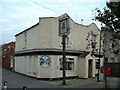
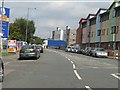
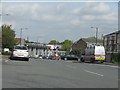
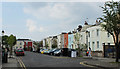
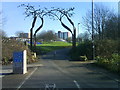
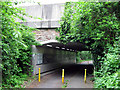
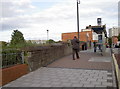
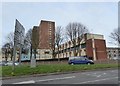
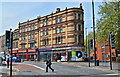
Photos of BS5 0TQ


Area Information
BS5 0TQ is a small residential postcode located on Pennywell Road in the Lawrence Hill ward of Bristol. It lies within the city’s built-up area, blending urban convenience with a residential feel. The area is served by several nearby railway stations, including Stapleton Road, Lawrence Hill, Montpelier, and Bristol Temple Meads, all within a mile. This connectivity makes it accessible for commuters, with the Avon and Somerset Constabulary’s Trinity policing neighbourhood ensuring local safety. The postcode falls under the City of Bristol, in the South West region, and is defined by its compact cluster of homes. Daily life here is shaped by proximity to Bristol’s cultural and commercial hubs, with the nearby Montpelier area offering a mix of independent shops, cafes, and green spaces. The area’s small size means it is tightly integrated with surrounding neighbourhoods, creating a sense of cohesion. For those seeking a balance between city life and residential tranquillity, BS5 0TQ offers a microcosm of Bristol’s urban character, with homes typically located in established housing stock. The postcode’s specific location, coordinates 51.462227, -2.577006, places it in a historically developed part of the city, where living in BS5 0TQ means being part of a well-connected, compact community.
- Area Type
- Postcode
- Area Size
- 4009 m²
- Population
- 2535
- Population Density
- 6694 people/km²
The property market in BS5 0TQ reflects a mix of owner-occupied homes and rental properties, typical of Bristol’s inner-city areas. While exact home ownership percentages are not specified, the area’s small size suggests a concentration of mid-sized properties, likely including terraced houses and flats. Proximity to key transport links, such as the nearby railway stations, may influence property values, with buyers prioritising accessibility to Bristol’s central amenities. The area’s compact nature means that homes in BS5 0TQ are often part of larger residential clusters, offering a blend of established housing stock and potential for redevelopment. For buyers, this small postcode area and its immediate surroundings present opportunities in a market where demand is driven by location rather than large-scale expansion. The presence of nearby amenities, including schools and community hubs, further supports a stable property market. However, the limited size of BS5 0TQ means that availability is constrained, requiring buyers to consider adjacent areas for more options. Homes in BS5 0TQ are likely to cater to a range of needs, from first-time buyers to those seeking a base for city commuting.
House Prices in BS5 0TQ
No properties found in this postcode.
Energy Efficiency in BS5 0TQ
Amenities
Schools
| Rank | School | Type | Entry gender | Ages |
|---|
Explore more schools in this area
Go to Schools tabDemographics
Household Size
Accommodation Type
Tenure
Ethnic Group
Religion
Household Composition
Age
Household Deprivation
NS-SEC
Explore more demographic insights in this area
Go to Demographics tabPlanning
Planning Constraints
- Flood RiskPremium
- Ramsar Wetland SitesPremium
- Area of Outstanding Natural BeautyPremium
- Protected Nature ReservePremium
- Protected WoodlandPremium