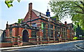
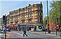
Area Overview for BS5 0PE
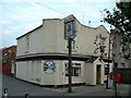
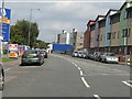
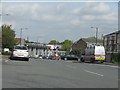
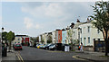
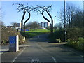
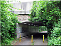
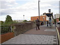
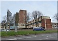
Photos of BS5 0PE


Area Information
BS5 0PE is a small residential postcode in Bristol, nestled within the BS5 district that includes areas like Easton, St George, Whitehall, and Lawrence Hill. Located at coordinates 51.463583 latitude and -2.569984 longitude, this area is part of the city’s bustling urban core, offering proximity to amenities, transport links, and cultural hubs. With a population density of 7,131.8 people per square kilometre, it reflects a tightly packed, active community. Daily life here is shaped by the city’s rhythm, with easy access to Bristol’s landmarks, green spaces, and the M32 motorway. The area’s multicultural character is evident in its diversity, with 40.4% of residents holding Level 4 qualifications, suggesting a mix of professionals and students. Living in BS5 0PE means navigating a vibrant, high-density environment where urban convenience meets the challenges of limited space. For those seeking a dynamic, centrally located home, this postcode offers a compact snapshot of Bristol’s energetic urban fabric.
- Area Type
- Postcode
- Area Size
- Not available
- Population
- Not available
- Population Density
- Not available
The property market in BS5 0PE is shaped by its high population density and urban setting. With an average house price of £205,000, the area reflects a balance between affordability and demand in Bristol’s competitive market. The presence of a diverse, skilled workforce—40.4% with Level 4 qualifications—suggests a mix of owner-occupied homes and rental properties, though specific ownership rates are not provided. Given the postcode’s small size and proximity to central Bristol, properties here are likely to be smaller, such as terraced houses or flats, catering to professionals and commuters. Buyers should consider the area’s limited space and the potential for higher rental demand, driven by nearby employment hubs. For those seeking a compact, centrally located home, BS5 0PE offers a snapshot of Bristol’s urban housing stock, though its small size means the surrounding postcode districts may hold more varied options.
House Prices in BS5 0PE
No properties found in this postcode.
Energy Efficiency in BS5 0PE
Amenities
Schools
| Rank | School | Type | Entry gender | Ages |
|---|
Explore more schools in this area
Go to Schools tabDemographics
BS5 0PE’s community is defined by its high population density and educational profile. Nearly 40.4% of residents hold Level 4 qualifications, indicating a workforce skewed toward skilled and professional roles. This aligns with the area’s average salary of £31,610, which exceeds the UK average, suggesting a mix of middle-income earners and professionals. While specific data on age distribution or household types is not available, the postcode’s density implies a concentration of smaller households, possibly including students or young professionals. The area’s multicultural makeup is likely reflected in its local amenities and social dynamics, though exact figures on diversity are not provided. The absence of explicit deprivation metrics means the quality of life here is inferred from economic indicators alone. For buyers, this suggests a community prioritising access to urban resources over suburban sprawl, with a focus on proximity to employment and services.
Household Size
Accommodation Type
Tenure
Ethnic Group
Religion
Household Composition
Age
Household Deprivation
NS-SEC
Explore more demographic insights in this area
Go to Demographics tabPlanning
Planning Constraints
- Flood RiskPremium
- Ramsar Wetland SitesPremium
- Area of Outstanding Natural BeautyPremium
- Protected Nature ReservePremium
- Protected WoodlandPremium