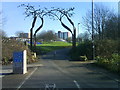
Area Overview for BS5 0EW
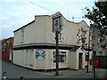
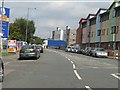
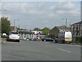
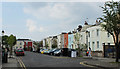
Photos of BS5 0EW
Area Information
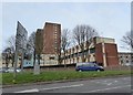
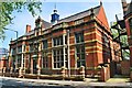
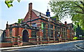
BS5 0EW represents a specific postcode area covering a small residential cluster within the east of Bristol. This location falls within the Lawrence Hill electoral ward, which encompasses districts such as Barton Hill, St Philips Marsh, and Temple Meads. The area sits near the intersection of the A420 and A4320 roads, known as the Lawrence Hill roundabout. Originally named St Lawrence Hill after a medieval leper hospital founded by King John, the locality retains deep historical roots while functioning as a modern residential zone. The total area size is just 1526 m², housing a population of 2774 people. The density reaches 1817706 people/km², indicating a highly concentrated living environment typical of urban wards. Living in BS5 0EW means being situated in a zone that includes the start of the Bristol and Bath Railway Path in its southern part. You are located near significant transport hubs, including Lawrence Hill Railway Station and the Broadmead shopping area. The ward also touches the 13-storey Kingsmarsh House and other mid-1960s tower blocks. This compact footprint defines daily life, offering immediate access to the city centre while maintaining a distinct neighbourhood identity centred around the St Lawrence's Church site before its closure in 1954.
- Area Type
- Postcode
- Area Size
- 1526 m²
- Population
- Not available
- Population Density
- Not available
Homes in BS5 0EW present a specific property market character driven by high-density living. The data indicates a 20% home ownership rate, confirming this is overwhelmingly a rental environment. Flats constitute the predominant accommodation type, aligning with the urban ward structure defined by multi-storey blocks like Kingsmarsh House. You are looking at a market where purchasing a freehold property is rare, and renting is the standard tenant experience. This small residential cluster covers 1526 m², limiting the overall housing stock size within this specific postcode boundary. The Ardwell College history in the ward name area suggests a long-term institutional presence that may influence land use, though current stock remains residential. The high population of 2774 within such a compact area drives demand for flats over houses. Buyers considering this area must adjust expectations towards rental agreements rather than traditional purchase options. The clustering of residents in flats means you will find interior-focused living spaces rather than extensive exterior plots. This market dynamic suits professionals and those comfortable with flat living arrangements typical of the Lawrence Hill ward.
House Prices in BS5 0EW
Showing 10 properties
| Address | Type | Beds | Baths | Last Sale Price | Last Sale Date | |
|---|---|---|---|---|---|---|
| Flat 3, Tan House, 3 Clayton Street, Easton, Bristol, BS5 0EW | Maisonette | 2 | 1 | £115,000 | May 2015 | |
| 6 Clayton Street, Easton, Bristol, BS5 0EW | Flat | - | - | - | - | |
| 5 Clayton Street, Easton, Bristol, BS5 0EW | Flat | - | - | - | - | |
| 1 Clayton Street, Easton, Bristol, BS5 0EW | house | - | - | - | - | |
| 2 Clayton Street, Easton, Bristol, BS5 0EW | house | - | - | - | - | |
| Flat 1, Tan House, 3 Clayton Street, Easton, Bristol, BS5 0EW | Flat | - | - | - | - | |
| Flat 2, Tan House, 3 Clayton Street, Easton, Bristol, BS5 0EW | Flat | - | - | - | - | |
| Flat 4, Tan House, 3 Clayton Street, Easton, Bristol, BS5 0EW | Flat | - | - | - | - | |
| 7 Clayton Street, Easton, Bristol, BS5 0EW | Flat | - | - | - | - | |
| 4 Clayton Street, Easton, Bristol, BS5 0EW | Flat | - | - | - | - |
Energy Efficiency in BS5 0EW
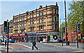
Daily convenience in BS5 0EW revolves around a cluster of retail and transport amenities within practical reach. You have access to five retail outlets, including Iceland Easton, Lidl Easton, and Tesco Redfield. These supermarkets form the backbone of local grocery shopping. For transport enthusiasts and commuters, five rail stations and five ferry terminals provide extensive mobility options. Lawrence Hill Railway Station places you centrally in the transport network. Leisure and green spaces are anchored by the Bristol and Bath Railway Path, which begins in the southern part of the ward. You are also near the historic site of St Lawrence's Hospital, originally founded by King John. The local area includes mid-1960s tower blocks like the 13-storey Kingsmarsh House, creating a distinctive architectural landscape. Five ferry services including Netham Lock Freight Terminal add to the transport variety. One airport, Bristol Filton Airport, provides additional regional connectivity. This mix of retail giants, historical sites, and transport hubs defines the lifestyle in BS5 0EW.
Amenities
Schools
Families considering BS5 0EW have access to a designated range of educational institutions nearby. Spring Woods Nursery School serves the youngest children in the immediate vicinity. For primary education, Bannerman Road Community School and Children's Centre provides schooling for young students. Secondary provision is covered by E-Act Bannerman Road Community Academy, which holds a good Ofsted rating. This mix of nursery, primary, and secondary academies creates a continuous educational pathway for residents. The presence of a school rated good offers a concrete indicator of educational quality within the ward. You will find that schools near BS5 0EW include these specific named entities without alternative options listed in the local data. This concentration of educational facilities supports the adult population with children, as noted in the demographics data.
| Rank | School | Type | Entry gender | Ages |
|---|
Explore more schools in this area
Go to Schools tabDemographics
The resident profile in BS5 0EW is dominated by adults between 30 and 64 years old. The median age for the population is 47 years, reflecting a mature community compared to national averages. Home ownership stands at a low 20%, meaning four out of five residents are likely renting rather than owning their property. This high rental proportion suggests the area attracts tenants across various life stages rather than settled owner-occupiers. Accommodation types are primarily flats, fitting the urban, high-density nature of the cluster. The ethnic composition shows black_total as the predominant group, indicating a diverse neighbourhood with significant multicultural influences. These demographic facts shape the local character of BS5 0EW. You will find an environment where a large majority of residents do not own their homes. The concentration of adults in the 30-64 age range combined with a predominantly black population creates a distinct social fabric. The low home ownership rate of 20% contrasts with the mature age profile, suggesting a transient population within a stable age bracket. Flats remain the standard housing form, catering to those seeking dense urban living rather than standalone gardens or large family homes.
Household Size
Accommodation Type
Tenure
Ethnic Group
Religion
Household Composition
Age
Household Deprivation
NS-SEC
Explore more demographic insights in this area
Go to Demographics tabPlanning
Planning Constraints
- Flood RiskPremium
- Ramsar Wetland SitesPremium
- Area of Outstanding Natural BeautyPremium
- Protected Nature ReservePremium
- Protected WoodlandPremium