Area Overview for BS5 0ED
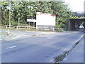
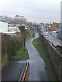
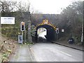
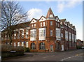
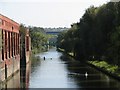
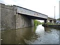
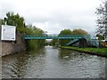
Photos of BS5 0ED

Area Information
Living in BS5 0ED offers proximity to major urban centres while maintaining a defined residential character. This specific postcode cluster covers an area of 6415 square metres and serves 1744 people. The density is notably high, standing at 271,864 people per square kilometre according to available records. You are situated within the Lawrence Hill electoral ward in Bristol, which historically traces its origins to St Lawrence's Hospital founded by King John in the late 12th century. The locality encompasses districts such as Barton Hill, St Philips Marsh, and parts of Easton, placing you near significant transport hubs like Lawrence Hill and Bristol Temple Meads. Daily life here is shaped by major road infrastructure, including the A420 and A4320 intersecting at the Lawrence Hill roundabout. The southern part of the wider ward features the start of the Bristol and Bath Railway Path, providing walking and cycling routes. You will find yourself in an environment defined by its connection to the city's broader social and historical landscape, from medieval foundations to mid-20th-century tower blocks.
- Area Type
- Postcode
- Area Size
- 6415 m²
- Population
- Not available
- Population Density
- Not available
The property market in BS5 0ED is defined by a high proportion of rented accommodations and a scarcity of owner-occupied homes. Current statistics show that 29 per cent of households own their homes, meaning the private rental sector is extensive. The predominant accommodation type is flats, which aligns with the high population density of 1744 residents within 6415 square metres. You should expect to find mostly flat properties rather than detached or semi-detached houses when searching for homes in this postcode. The historical context of the area includes mid-1960s tower blocks such as Kingsmarsh House, Moorfields, and Baynton Houses, of which some are 13 storeys tall. This legacy influences the current stock, often providing larger flat units within larger buildings. As a buyer, you are entering a market where long-term ownership is less common than renting. The small size of the postcode area limits the total number of listings available compared to larger neighbourhoods. Visualising your future living situation requires understanding that most homes here are multi-unit developments designed for high-density urban living.
House Prices in BS5 0ED
Showing 9 properties
| Address | Type | Beds | Baths | Last Sale Price | Last Sale Date | |
|---|---|---|---|---|---|---|
| 115 Barrow Road, Lawrence Hill, Bristol, BS5 0ED | Terraced | 2 | 2 | £235,000 | May 2019 | |
| 113 Barrow Road, Lawrence Hill, Bristol, BS5 0ED | Terraced | 2 | 2 | £260,001 | Jun 2018 | |
| 117 Barrow Road, Lawrence Hill, Bristol, BS5 0ED | house | - | - | £90,000 | Sep 2017 | |
| 111 Barrow Road, Lawrence Hill, Bristol, BS5 0ED | Terraced | - | - | £52,000 | May 2009 | |
| 107 Barrow Road, Lawrence Hill, Bristol, BS5 0ED | house | - | - | £52,000 | Mar 2009 | |
| 109 Barrow Road, Lawrence Hill, Bristol, BS5 0ED | house | - | - | - | - | |
| 105 Barrow Road, Lawrence Hill, Bristol, BS5 0ED | house | - | - | - | - | |
| 103 Barrow Road, Lawrence Hill, Bristol, BS5 0ED | house | - | - | - | - | |
| 119 Barrow Road, Lawrence Hill, Bristol, BS5 0ED | house | - | - | - | - |
Energy Efficiency in BS5 0ED
Your lifestyle in BS5 0ED is supported by a range of amenities within practical reach. Five railway stations are available nearby, including Lawrence Hill Railway Station, Bristol Temple Meads Railway Station, and Stapleton Road Railway Station. For daily shopping needs, you have access to four retail options within the immediate vicinity. Lidl Easton, Iceland Easton, and Lidl St are among the named supermarkets you can visit for groceries and essentials. There are also five ferry terminals accessible, which may provide unique travel options or commute routes to other areas of the estuary. Netham Lock Ferry Terminal, Temple Meads Station Ferry Landing, and Temple Bridge Ferry Landing are the specific venues available. Bristol Filton Airport is one of the five airports listed near the postal code, though this may serve business or leisure travellers rather than daily commute needs. Two metro services connect you to areas like Bitton and Oldland. The combination of rail, road, and ferry options ensures you have multiple methods to reach your destination regardless of traffic or weather conditions.
Amenities
Schools
Families considering children in BS5 0ED have access to specific educational institutions nearby. Hannah More Primary School is the only primary school listed in the data for this area. It holds an Ofsted rating of good and serves as a key option for local children. No secondary schools appear in the provided list for this specific postcode, though the wider Lawrence Hill ward contains districts like Temple Meads and Easton that might offer further options. The presence of a single listed primary school suggests families may need to look beyond immediate proximity for secondary education. You should verify catchment areas directly with the school if you have children attending under the system's current arrangements. The available data confirms Hannah More Primary School as a rated institution close to where you reside or plan to reside. Families often rely on transport links to reach additional schools in the city centre or nearby suburbs if the local provision does not meet their specific needs.
| Rank | School | Type | Entry gender | Ages |
|---|
Explore more schools in this area
Go to Schools tabDemographics
The community in BS5 0ED reflects a young demographic profile with a median age of 22 years. While the most common age range among residents is between 30 and 64 years, the low median age suggests a significant presence of younger adults. Accommmodation types are predominately flats, indicating a population accustomed to urban living arrangements. Home ownership figures are low, with only 29 per cent of households owning their homes outright. This leaves the majority of residents in the private rental sector, a fact you should consider when viewing properties in this cluster. The predominant ethnic group is White, though the area's high density and flat-dominant housing style suggest a mix of working professionals and students. There is no data provided on deprivation levels in the specific records for this postcode, so you must rely on broader Bristol trends to gauge quality of life factors. The population structure points to a transient or young professional environment rather than a traditional family settlement. You are buying into or renting within a high-density residential zone where fewer than three out of every ten residents have full tenure security.
Household Size
Accommodation Type
Tenure
Ethnic Group
Religion
Household Composition
Age
Household Deprivation
NS-SEC
Explore more demographic insights in this area
Go to Demographics tabPlanning
Planning Constraints
- Flood RiskPremium
- Ramsar Wetland SitesPremium
- Area of Outstanding Natural BeautyPremium
- Protected Nature ReservePremium
- Protected WoodlandPremium