Area Overview for BS5 0BG
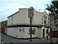
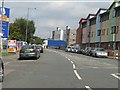
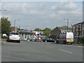
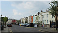
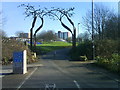
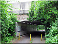
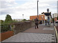
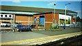
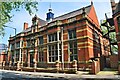
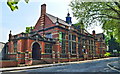
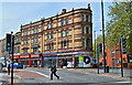
Photos of BS5 0BG
Area Information
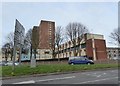
BS5 0BG is a small residential postcode in east Bristol, nestled within the Lawrence Hill electoral ward. This area blends historical roots with modern living, situated near landmarks such as St Philips Marsh, Redcliffe, and the Broadmead shopping district. With a population of 1,726, it reflects a compact, tight-knit community. The area’s name traces back to St Lawrence’s Hospital, a medieval leper house founded by King John, now marked by the Lawrence Hill roundabout where major roads like the A420 and A4320 converge. Daily life here is shaped by proximity to transport hubs, including five nearby railway stations such as Lawrence Hill and Bristol Temple Meads, and the Bristol and Bath Railway Path, ideal for walking or cycling. The high street near the train station is undergoing redevelopment, aiming to blend housing, workspaces, and community amenities. While the area features mid-20th-century tower blocks like Kingsmarsh House, it also offers a mix of retail and leisure options, making it a practical choice for those prioritising connectivity and convenience.
- Area Type
- Postcode
- Area Size
- Not available
- Population
- Not available
- Population Density
- Not available
BS5 0BG is predominantly a rental market, with only 20% of residents owning their homes. The accommodation type is primarily flats, a common feature in urban areas with limited space. This reflects the area’s density and the presence of mid-1960s tower blocks such as Kingsmarsh House, Moorfields, and Baynton Houses. These properties, while functional, may appeal to buyers seeking affordable housing in a well-connected location. However, the small size of the postcode and the dominance of rental stock suggest a competitive market with limited new developments. For buyers, this means prioritising properties in the existing stock, which may require renovations or adaptations to suit modern living needs. The proximity to transport links and amenities could offset the lack of owner-occupied homes, making it a viable option for those seeking convenience over long-term investment.
House Prices in BS5 0BG
No properties found in this postcode.
Energy Efficiency in BS5 0BG
Living in BS5 0BG offers access to a range of amenities within practical reach. Retail options include supermarkets like Lidl Easton, Iceland Easton, and Sainsburys Bristol, providing convenience for daily shopping. The high street near the train station is being revitalised, potentially adding new dining and retail spaces. For leisure, the Bristol and Bath Railway Path allows walking or cycling, while nearby ferry terminals offer scenic routes along the River Avon. The area’s proximity to Broadmead, a major shopping and entertainment hub, adds to its appeal. However, the lack of dedicated parks or green spaces within the postcode means residents may need to travel slightly further for outdoor recreation. Overall, the lifestyle here balances practicality with the potential for future development, though current amenities are modest.
Amenities
Schools
The nearest school to BS5 0BG is Cashmore Nursery School, which provides early education services. No primary or secondary schools are listed in the data, meaning families may need to look beyond the immediate area for comprehensive schooling. The absence of higher-tier educational institutions could be a consideration for parents prioritising proximity to schools. However, the presence of a nursery indicates some local support for young children, though it does not address the needs of older students. Families may need to rely on nearby districts such as Broadmead or Easton for primary and secondary education, which could add to commuting times. This highlights the importance of researching school catchment areas when evaluating the area’s suitability for families.
| Rank | School | Type | Entry gender | Ages |
|---|
Explore more schools in this area
Go to Schools tabDemographics
The population of BS5 0BG has a median age of 47, with the majority of residents falling within the 30-64 age range. This suggests a mature demographic, likely with established careers and families. Home ownership is relatively low at 20%, indicating that most residents are renters. The primary accommodation type is flats, which aligns with the area’s density and the presence of tower blocks. The predominant ethnic group is Black_total, reflecting a diverse community. While specific deprivation data is not provided, the age profile and housing stock suggest a mix of long-term residents and those seeking affordable rental options. The 20% home ownership rate may influence the local property market, with limited opportunities for buyers to purchase homes outright. The community’s character is shaped by its historical context and the practical realities of living in a compact, transport-linked postcode.
Household Size
Accommodation Type
Tenure
Ethnic Group
Religion
Household Composition
Age
Household Deprivation
NS-SEC
Explore more demographic insights in this area
Go to Demographics tabPlanning
Planning Constraints
- Flood RiskPremium
- Ramsar Wetland SitesPremium
- Area of Outstanding Natural BeautyPremium
- Protected Nature ReservePremium
- Protected WoodlandPremium