Area Overview for BS49 5ED
Photos of BS49 5ED

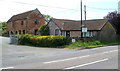
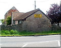
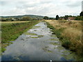
21 photos from this area
Area Information
Key information about the BS49 5ED including its size, population, and administrative classification.
- Area Type
- Postcode
- Area Size
- 1.0 km²
- Population
- 1889
- Population Density
- 175 people/km²
House Prices in BS49 5ED
19
Properties
£415,000
Average Sold Price
£160,000
Lowest Price
£680,000
Highest Price
Showing 19 properties
| Address | Type | Beds | Baths | Last Sale Price | Last Sale Date | |
|---|---|---|---|---|---|---|
| Oak House, Old Weston Road, Congresbury, BS49 5ED | Detached | 4 | 3 | £680,000 | Jul 2025 | |
| Oakdene, Weston Road, Congresbury, BS49 5ED | Bungalow | - | - | £450,000 | Sep 2021 | |
| Withydale Farm, Weston Road, Congresbury, BS49 5ED | Detached | 4 | 1 | £450,000 | May 2021 | |
| Heath Cottage, Old Weston Road, Congresbury, BS49 5ED | house | - | - | £410,000 | Nov 2016 | |
| Lilymead Farm, Dolemoor Lane, Congresbury, BS49 5ED | Detached | - | - | £340,000 | Oct 2002 | |
| Honeymeade, Old Weston Road, Congresbury, BS49 5ED | Land | - | - | £160,000 | Feb 2002 | |
| Harley Kennels, Dolemoor Lane, Congresbury, BS49 5ED | commercial | 4 | - | - | - | |
| Farm House, Stepstones Farm, Dolemoor Lane, Congresbury, BS49 5ED | Detached | - | - | - | - | |
| Mobile Home, Stepstones Farm, Dolemoor Lane, Congresbury, BS49 5ED | Mobile Home | - | - | - | - | |
| Workshop, Withydale Farm, Weston Road, Congresbury, BS49 5ED | Industrial | - | - | - | - |
Page 1 of 2
Energy Efficiency in BS49 5ED
Amenities
Schools
| Rank | School | Type | Entry gender | Ages |
|---|
Explore more schools in this area
Go to Schools tabDemographics
Household Size
Two person
most common
Accommodation Type
Houses
most common
Tenure
81
majority
Ethnic Group
White
most common
Religion
N/A
most common
Household Composition
N/A
most common
Age
47
median
Adults (30-64 years)
most common
Household Deprivation
N/A
with no deprivation
NS-SEC
42
in Lower managerial occupations
Explore more demographic insights in this area
Go to Demographics tabPlanning
Planning Constraints
- Flood RiskPremium
- Ramsar Wetland SitesPremium
- Area of Outstanding Natural BeautyPremium
- Protected Nature ReservePremium
- Protected WoodlandPremium