Area Overview for BS49 4RL
Photos of BS49 4RL


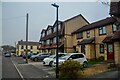


89 photos from this area
Area Information
Key information about the BS49 4RL including its size, population, and administrative classification.
- Area Type
- Postcode
- Area Size
- 1.4 hectares
- Population
- 1496
- Population Density
- 1654 people/km²
House Prices in BS49 4RL
28
Properties
£286,689
Average Sold Price
£85,000
Lowest Price
£480,000
Highest Price
Showing 28 properties
| Address | Type | Beds | Baths | Last Sale Price | Last Sale Date | |
|---|---|---|---|---|---|---|
| 12 Moorside, Yatton, BS49 4RL | Retail | 4 | 2 | £445,000 | Oct 2022 | |
| 15 Moorside, Yatton, BS49 4RL | house | - | - | £420,000 | Sep 2021 | |
| 16 Moorside, Yatton, BS49 4RL | Detached | 4 | 2 | £390,000 | Aug 2020 | |
| 10 Moorside, Yatton, BS49 4RL | Detached | 4 | 2 | £460,000 | Dec 2019 | |
| 21 Moorside, Yatton, BS49 4RL | house | - | - | £480,000 | Jul 2019 | |
| 5 Moorside, Yatton, BS49 4RL | house | - | - | £433,500 | Apr 2019 | |
| 2 Moorside, Yatton, BS49 4RL | Detached | 4 | - | £422,500 | Jul 2017 | |
| 17 Moorside, Yatton, BS49 4RL | Detached | 5 | - | £318,500 | Apr 2015 | |
| 28 Moorside, Yatton, BS49 4RL | house | 4 | - | £345,000 | Mar 2015 | |
| 26 Moorside, Yatton, BS49 4RL | Detached | 4 | 3 | £392,000 | Apr 2014 |
Page 1 of 3
Energy Efficiency in BS49 4RL
Amenities
Schools
| Rank | School | Type | Entry gender | Ages |
|---|
Explore more schools in this area
Go to Schools tabDemographics
Household Size
Two person
most common
Accommodation Type
Houses
most common
Tenure
80
majority
Ethnic Group
White
most common
Religion
N/A
most common
Household Composition
N/A
most common
Age
47
median
Adults (30-64 years)
most common
Household Deprivation
N/A
with no deprivation
NS-SEC
43
in Lower managerial occupations
Explore more demographic insights in this area
Go to Demographics tabPlanning
Planning Constraints
- Flood RiskPremium
- Ramsar Wetland SitesPremium
- Area of Outstanding Natural BeautyPremium
- Protected Nature ReservePremium
- Protected WoodlandPremium