Area Overview for BS49 4QS
Photos of BS49 4QS
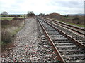
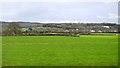
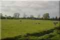
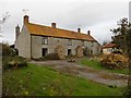
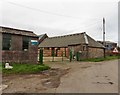
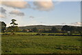
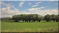
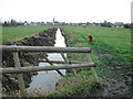
19 photos from this area
Area Information
Key information about the BS49 4QS including its size, population, and administrative classification.
- Area Type
- Postcode
- Area Size
- 8.9 hectares
- Population
- 1496
- Population Density
- 1654 people/km²
House Prices in BS49 4QS
20
Properties
£185,550
Average Sold Price
£76,000
Lowest Price
£250,000
Highest Price
Showing 20 properties
| Address | Type | Beds | Baths | Last Sale Price | Last Sale Date | |
|---|---|---|---|---|---|---|
| 198 Stowey Road, Yatton, BS49 4QS | house | - | - | £245,000 | Jun 2021 | |
| 218 Stowey Road, Yatton, BS49 4QS | house | - | - | £250,000 | May 2021 | |
| 220 Stowey Road, Yatton, BS49 4QS | house | - | - | £230,000 | Nov 2019 | |
| 212 Stowey Road, Yatton, BS49 4QS | Terraced | 3 | - | £220,000 | Sep 2019 | |
| 200 Stowey Road, Yatton, BS49 4QS | Terraced | 3 | - | £225,000 | Jul 2017 | |
| 204 Stowey Road, Yatton, BS49 4QS | house | 3 | - | £153,500 | Jan 2011 | |
| 184 Stowey Road, Yatton, BS49 4QS | Terraced | - | - | £168,500 | Jul 2006 | |
| 186 Stowey Road, Yatton, BS49 4QS | Terraced | - | - | £155,000 | Dec 2005 | |
| 208 Stowey Road, Yatton, BS49 4QS | Terraced | - | - | £132,500 | Aug 2004 | |
| 202 Stowey Road, Yatton, BS49 4QS | Semi-detached | - | - | £76,000 | Aug 1997 |
Page 1 of 2
Energy Efficiency in BS49 4QS
Amenities
Schools
| Rank | School | Type | Entry gender | Ages |
|---|
Explore more schools in this area
Go to Schools tabDemographics
Household Size
Two person
most common
Accommodation Type
Houses
most common
Tenure
80
majority
Ethnic Group
White
most common
Religion
N/A
most common
Household Composition
N/A
most common
Age
47
median
Adults (30-64 years)
most common
Household Deprivation
N/A
with no deprivation
NS-SEC
43
in Lower managerial occupations
Explore more demographic insights in this area
Go to Demographics tabPlanning
Planning Constraints
- Flood RiskPremium
- Ramsar Wetland SitesPremium
- Area of Outstanding Natural BeautyPremium
- Protected Nature ReservePremium
- Protected WoodlandPremium