Area Overview for BS49 4JH
Photos of BS49 4JH
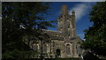
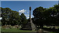
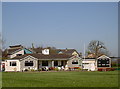
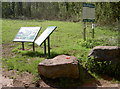
100 photos from this area
Area Information
Key information about the BS49 4JH including its size, population, and administrative classification.
- Area Type
- Postcode
- Area Size
- 2.5 hectares
- Population
- 1495
- Population Density
- 2917 people/km²
House Prices in BS49 4JH
41
Properties
£213,471
Average Sold Price
£48,500
Lowest Price
£345,000
Highest Price
Showing 41 properties
| Address | Type | Beds | Baths | Last Sale Price | Last Sale Date | |
|---|---|---|---|---|---|---|
| 8 Henley Park, Yatton, BS49 4JH | house | - | - | £295,000 | Jan 2025 | |
| 37 Henley Park, Yatton, BS49 4JH | house | 3 | 1 | £325,000 | Sep 2021 | |
| 31 Henley Park, Yatton, BS49 4JH | house | - | - | £300,000 | Sep 2021 | |
| 7 Henley Park, Yatton, BS49 4JH | Semi-detached | 3 | 1 | £287,500 | Aug 2021 | |
| 30 Henley Park, Yatton, BS49 4JH | Semi-detached | 3 | - | £200,000 | Jun 2021 | |
| 38A Henley Park, Yatton, BS49 4JH | house | - | - | £345,000 | Mar 2019 | |
| 38 Henley Park, Yatton, BS49 4JH | Semi-detached | - | - | £210,000 | Mar 2018 | |
| 17 Henley Park, Yatton, BS49 4JH | Semi-detached | 2 | - | £200,000 | Dec 2015 | |
| 14 Henley Park, Yatton, BS49 4JH | Semi-detached | 3 | - | £205,000 | Dec 2015 | |
| 6 Henley Park, Yatton, BS49 4JH | Detached | 4 | 2 | £229,500 | Sep 2015 |
Page 1 of 5
Energy Efficiency in BS49 4JH
Amenities
Schools
| Rank | School | Type | Entry gender | Ages |
|---|
Explore more schools in this area
Go to Schools tabDemographics
Household Size
Family (3-5 people)
most common
Accommodation Type
Houses
most common
Tenure
75
majority
Ethnic Group
White
most common
Religion
N/A
most common
Household Composition
N/A
most common
Age
47
median
Adults (30-64 years)
most common
Household Deprivation
N/A
with no deprivation
NS-SEC
33
in Lower managerial occupations
Explore more demographic insights in this area
Go to Demographics tabPlanning
Planning Constraints
- Flood RiskPremium
- Ramsar Wetland SitesPremium
- Area of Outstanding Natural BeautyPremium
- Protected Nature ReservePremium
- Protected WoodlandPremium