Area Overview for BS49 4HX
Photos of BS49 4HX
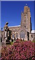
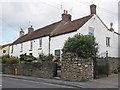
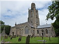
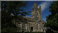
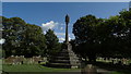
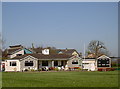
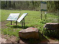
100 photos from this area
Area Information
Key information about the BS49 4HX including its size, population, and administrative classification.
- Area Type
- Postcode
- Area Size
- 3.9 hectares
- Population
- 1496
- Population Density
- 1654 people/km²
House Prices in BS49 4HX
18
Properties
£263,717
Average Sold Price
£76,000
Lowest Price
£490,000
Highest Price
Showing 18 properties
| Address | Type | Beds | Baths | Last Sale Price | Last Sale Date | |
|---|---|---|---|---|---|---|
| 32 Stowey Road, Yatton, BS49 4HX | Detached | 6 | 2 | £490,000 | Dec 2025 | |
| 18 Stowey Road, Yatton, BS49 4HX | Detached | 4 | 2 | £490,000 | Dec 2024 | |
| 25 Stowey Road, Yatton, BS49 4HX | Detached | 4 | - | £390,000 | Jul 2018 | |
| Fieldway, 2 Stowey Road, Yatton, BS49 4HX | Bungalow | 2 | 1 | £238,500 | Jun 2013 | |
| 26 Stowey Road, Yatton, BS49 4HX | house | 4 | - | £229,950 | Jun 2012 | |
| 28 Stowey Road, Yatton, BS49 4HX | Detached | - | - | £235,000 | Nov 2004 | |
| 23 Stowey Road, Yatton, BS49 4HX | Detached | - | - | £128,000 | Jan 2000 | |
| 22 Stowey Road, Yatton, BS49 4HX | Terraced | - | - | £96,000 | Aug 1996 | |
| 38 Stowey Road, Yatton, BS49 4HX | Detached | - | - | £76,000 | Nov 1995 | |
| 20 Stowey Road, Yatton, BS49 4HX | Detached | 3 | 1 | - | - |
Page 1 of 2
Energy Efficiency in BS49 4HX
Amenities
Schools
| Rank | School | Type | Entry gender | Ages |
|---|
Explore more schools in this area
Go to Schools tabDemographics
Household Size
Two person
most common
Accommodation Type
Houses
most common
Tenure
80
majority
Ethnic Group
White
most common
Religion
N/A
most common
Household Composition
N/A
most common
Age
47
median
Adults (30-64 years)
most common
Household Deprivation
N/A
with no deprivation
NS-SEC
43
in Lower managerial occupations
Explore more demographic insights in this area
Go to Demographics tabPlanning
Planning Constraints
- Flood RiskPremium
- Ramsar Wetland SitesPremium
- Area of Outstanding Natural BeautyPremium
- Protected Nature ReservePremium
- Protected WoodlandPremium