Area Overview for BS49 4ED
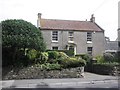
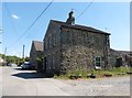
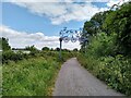
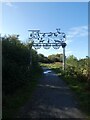
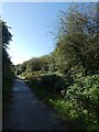
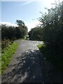
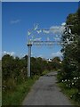
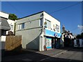
Photos of BS49 4ED


Area Information
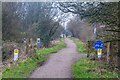
BS49 4ED is a small residential cluster situated within the parish of Yatton in North Somerset, approximately 11 miles south-west of Bristol. The area covers just over 4,320 square metres and holds a population of roughly 1,500 people. This compact size means community life is likely tight-knit, reflecting the settlement's history as a village built on the North Somerset Levels. Historically, the land was characterised by low-lying ground comprising peat and estuarine alluvium, crossing numerous watercourses. Early settlement focused on slightly higher, drained areas known locally as batches, surrounded by moorland. The site itself sits on the Winterstoke Hundred. Living here connects you directly to a location with deep historical roots, including Iron Age settlements and Roman ruins nearby. The area offers a specific postcode environment rather than a sprawling urban zone. It serves as a satellite point for the wider Yatton community, providing a defined home base for those looking at houses in this specific cluster. Daily life likely involves easy access to the surrounding moorland and the distinctive landscape of the Severn Estuary area. The physical scale ensures that residents are part of a smaller, more manageable group within the larger parish structure.
- Area Type
- Postcode
- Area Size
- 4320 m²
- Population
- 1500
- Population Density
- 3015 people/km²
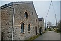
BS49 4ED represents a distinct segment of the local housing market defined by its specific postcode cluster and residential nature. Almost 84% of the households own their homes, distinguishing this area from rental enclaves common in urban centres. The predominant accommodation type consists of houses, reinforcing the village character andhistoric settlement patterns found in Yatton. This high ownership percentage indicates a market driven by purchase rather than private renting, often reflecting families who have bought property over several decades since the area became a commuter hub in the 19th century. For buyers seeking homes in this area, the landscape is largely established rather than expiation by new developments. The small land size of the cluster means properties are close together, offering a village feel rather than suburban sprawl. The area serves as a practical居住地 for those working in Bristol, given the region's function as a commuter settlement. Inventory here focuses on stock that accommodates the needs of the 30-64 age demographic. The market operates within a context where land scarcity in the 4,320 square metre zone maintains value for existing stock. The dominance of owner-occupiers suggests a quieter, less volatile market compared to high-pressure city fringe locations.
House Prices in BS49 4ED
Showing 12 properties
| Address | Type | Beds | Baths | Last Sale Price | Last Sale Date | |
|---|---|---|---|---|---|---|
| 215 Mendip Road, Yatton, BS49 4ED | Detached | 3 | 1 | £345,000 | Oct 2025 | |
| 213 Mendip Road, Yatton, BS49 4ED | house | 3 | 1 | £350,000 | Mar 2025 | |
| 205 Mendip Road, Yatton, BS49 4ED | house | - | - | £275,000 | Apr 2024 | |
| 198 Mendip Road, Yatton, BS49 4ED | Semi-detached | 4 | 2 | £388,000 | Mar 2024 | |
| 196 Mendip Road, Yatton, BS49 4ED | house | 3 | - | £280,000 | Jun 2021 | |
| 194 Mendip Road, Yatton, BS49 4ED | house | - | - | £187,500 | Oct 2015 | |
| 209 Mendip Road, Yatton, BS49 4ED | Detached | 3 | 1 | £208,000 | Jun 2015 | |
| 203 Mendip Road, Yatton, BS49 4ED | Semi-detached | 4 | 1 | £204,000 | Oct 2013 | |
| 200 Mendip Road, Yatton, BS49 4ED | Detached | - | - | £72,950 | Aug 1996 | |
| 192 Mendip Road, Yatton, BS49 4ED | Semi-detached | - | - | - | - |
Energy Efficiency in BS49 4ED
Daily life in BS49 4ED centres on practical amenities located within easy reach of the residential cluster. Five retail outlets serve local shoppers, including Co-op Yatton, Tesco Congresbury, and The Southern Co-operative Co. These stores provide essential groceries and daily necessities without requiring long travel. Four railway stations act as major hubs, specifically Yatton Railway Station, Nailsea & Backwell Railway Station, and Worle Railway Station, facilitating regular travel to nearby towns and Bristol. Residents also enjoy leisure connections via Clevedon Pier, the single ferry option nearby for coastal access. The area functions effectively as a commuter settlement linked to Bristol, supported by the Bristol & Exeter Railway established in the 1840s. Living near these transport nodes allows for quick trips to the city or visits to the seaside at Clevedon. The retail presence at Co-op Yatton and Tesco Congresbury means you do not need to drive far for basic shopping. This blend of rail connectivity, local supermarkets, and coastal access defines the lifestyle. The proximity of amenities ensures convenience for the mature population while maintaining a connection to the wider region.
Amenities
Schools
Families considering BS49 4ED have access to two primary educational institutions situated near the postcode. Yatton Voluntary Controlled Infant School operates as a traditional primary school providing early education for young children. For slightly older primary pupils, Yatton Infant School functions as an academy with a Ofsted rating of good. This rating indicates the school meets expected standards and provides quality education within the local council system. The presence of both a voluntary controlled school and an academy offers parents a choice in the type of governance and ethos for their children's primary education. Both institutions form part of the early years provision before students typically progress to secondary colleges further away in the parish or beyond. The proximity of these schools supports the high home ownership rates observed in the area, as families often purchase homes to align with catchment zones. For residents of BS49 4ED, the immediate educational environment is locally based, ensuring short journeys to Yatton Infant School and Yatton Voluntary Controlled Infant School. This mix supports a community where amenities are within practical walking or tutoring driving distance.
| Rank | School | Type | Entry gender | Ages |
|---|
Explore more schools in this area
Go to Schools tabDemographics
The community in BS49 4ED is dominated by adults, with the most common age range falling between 30 and 64 years. The median age for residents is 47, indicating a mature population typical of established settlements. Nearly 84% of this community owns their homes, suggesting a stable environment where households have remained in situ for significant periods. Houses are the predominant accommodation type, aligning with the area's classification as a residential cluster rather than a high-density housing block. The predominant ethnic group identifies as White, consistent with the broader demographic profile of North Somerset. High home ownership levels often correlate with families settled since the local economy shifted from agriculture to a commuter base for Bristol. The concentration of adults aged 30 to 64 suggests many households include grown children or empty-nester couples. This demographic balance avoids the transient feel of a student area or the isolation of a purely retirement home. The stable ownership rate implies low turnover and long-term neighbourhood relationships. Prospective buyers looking for an area where residents are rooted will find this profile matches those seeking a quiet residential neighbourhood.
Household Size
Accommodation Type
Tenure
Ethnic Group
Religion
Household Composition
Age
Household Deprivation
NS-SEC
Explore more demographic insights in this area
Go to Demographics tabPlanning
Planning Constraints
- Flood RiskPremium
- Ramsar Wetland SitesPremium
- Area of Outstanding Natural BeautyPremium
- Protected Nature ReservePremium
- Protected WoodlandPremium