Area Overview for BS49 4DW
Photos of BS49 4DW
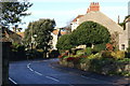
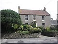
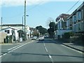
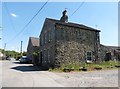
46 photos from this area
Area Information
Key information about the BS49 4DW including its size, population, and administrative classification.
- Area Type
- Postcode
- Area Size
- 1.4 hectares
- Population
- 1500
- Population Density
- 3015 people/km²
House Prices in BS49 4DW
38
Properties
£262,388
Average Sold Price
£62,500
Lowest Price
£560,000
Highest Price
Showing 38 properties
| Address | Type | Beds | Baths | Last Sale Price | Last Sale Date | |
|---|---|---|---|---|---|---|
| Myrtle Cottage, High Street, Yatton, BS49 4DW | house | - | - | £560,000 | Apr 2022 | |
| Chessum House, 77 High Street, Yatton, BS49 4DW | house | - | - | £298,600 | May 2021 | |
| 73 High Street, Yatton, BS49 4DW | Retail | 4 | - | £215,000 | Oct 2020 | |
| Westmoreland, 75 High Street, Yatton, BS49 4DW | Bungalow | - | - | £214,000 | May 2019 | |
| Ivy Cottage, 88 High Street, Yatton, BS49 4DW | Semi-detached | 4 | - | £330,000 | May 2016 | |
| 98 High Street, Yatton, BS49 4DW | house | 4 | - | £245,000 | Nov 2011 | |
| 90 High Street, Yatton, BS49 4DW | Semi-detached | 3 | 2 | £174,000 | Apr 2004 | |
| 92 High Street, Yatton, BS49 4DW | Terraced | - | - | £62,500 | Nov 1998 | |
| 96 High Street, Yatton, BS49 4DW | Terraced | 3 | 1 | - | - | |
| 79 High Street, Yatton, BS49 4DW | Semi-detached | 1 | 1 | - | - |
Page 1 of 4
Energy Efficiency in BS49 4DW
Amenities
Schools
| Rank | School | Type | Entry gender | Ages |
|---|
Explore more schools in this area
Go to Schools tabDemographics
Household Size
Two person
most common
Accommodation Type
Houses
most common
Tenure
84
majority
Ethnic Group
White
most common
Religion
N/A
most common
Household Composition
N/A
most common
Age
47
median
Adults (30-64 years)
most common
Household Deprivation
N/A
with no deprivation
NS-SEC
41
in Lower managerial occupations
Explore more demographic insights in this area
Go to Demographics tabPlanning
Planning Constraints
- Flood RiskPremium
- Ramsar Wetland SitesPremium
- Area of Outstanding Natural BeautyPremium
- Protected Nature ReservePremium
- Protected WoodlandPremium