Area Overview for BS49 4BD
Photos of BS49 4BD

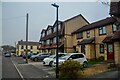
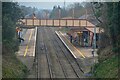
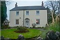
89 photos from this area
Area Information
Key information about the BS49 4BD including its size, population, and administrative classification.
- Area Type
- Postcode
- Area Size
- 3.9 hectares
- Population
- 1500
- Population Density
- 3015 people/km²
House Prices in BS49 4BD
44
Properties
£180,198
Average Sold Price
£50,500
Lowest Price
£308,000
Highest Price
Showing 44 properties
| Address | Type | Beds | Baths | Last Sale Price | Last Sale Date | |
|---|---|---|---|---|---|---|
| 33 Wemberham Crescent, Yatton, BS49 4BD | Semi-detached | 3 | 1 | £300,000 | Feb 2025 | |
| 19 Wemberham Crescent, Yatton, BS49 4BD | Semi-detached | 3 | 1 | £289,950 | Jun 2021 | |
| 63 Wemberham Crescent, Yatton, BS49 4BD | house | - | - | £285,000 | Jun 2021 | |
| 83 Wemberham Crescent, Yatton, BS49 4BD | Semi-detached | 3 | - | £276,000 | Apr 2021 | |
| 13 Wemberham Crescent, Yatton, BS49 4BD | Semi-detached | 3 | - | £292,500 | Aug 2020 | |
| 75 Wemberham Crescent, Yatton, BS49 4BD | house | - | - | £246,500 | Oct 2019 | |
| 1 Wemberham Crescent, Yatton, BS49 4BD | house | - | - | £244,950 | Feb 2018 | |
| Liddington, Wemberham Crescent, Yatton, BS49 4BD | house | - | - | £308,000 | Jun 2016 | |
| 57 Wemberham Crescent, Yatton, BS49 4BD | Semi-detached | 3 | - | £210,000 | Sep 2014 | |
| 11 Wemberham Crescent, Yatton, BS49 4BD | house | - | - | £215,000 | Jun 2014 |
Page 1 of 5
Energy Efficiency in BS49 4BD
Amenities
Schools
| Rank | School | Type | Entry gender | Ages |
|---|
Explore more schools in this area
Go to Schools tabDemographics
Household Size
Two person
most common
Accommodation Type
Houses
most common
Tenure
84
majority
Ethnic Group
White
most common
Religion
N/A
most common
Household Composition
N/A
most common
Age
47
median
Adults (30-64 years)
most common
Household Deprivation
N/A
with no deprivation
NS-SEC
41
in Lower managerial occupations
Explore more demographic insights in this area
Go to Demographics tabPlanning
Planning Constraints
- Flood RiskPremium
- Ramsar Wetland SitesPremium
- Area of Outstanding Natural BeautyPremium
- Protected Nature ReservePremium
- Protected WoodlandPremium