Area Overview for BS49 4BB
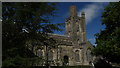
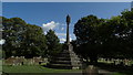
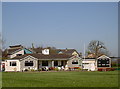
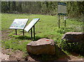
Photos of BS49 4BB
Area Information
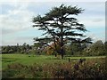
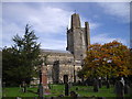
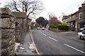
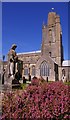
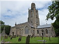
Living in BS49 4BB means being part of a small, tightly knit residential cluster in North Somerset. With a population of 1,500, the area offers a quiet, low-density lifestyle, typical of rural England. Situated on the North Somerset Levels, the village of Yatton, which this postcode covers, sits on slightly elevated ground known locally as a “batch,” surrounded by moorland and watercourses. This geographical feature has shaped its history, with evidence of Iron Age and Roman occupation nearby. Today, the area is a commuter hub for Bristol, thanks to its railway links and proximity to major roads. Daily life here balances rural tranquillity with access to essential services. The community is predominantly middle-aged, with a strong focus on home ownership. Residents benefit from good broadband connectivity and a range of nearby amenities, including schools, shops, and transport links. While the area lacks major urban infrastructure, its charm lies in its historical roots and manageable scale, making it ideal for those seeking a peaceful yet connected lifestyle.
- Area Type
- Postcode
- Area Size
- Not available
- Population
- 1500
- Population Density
- 3015 people/km²
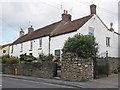
The property market in BS49 4BB is characterised by high home ownership (84%) and a focus on houses rather than flats or apartments. This suggests a stable, owner-occupied market with limited rental activity. The predominance of houses indicates a traditional, rural housing stock, likely with larger gardens and more space than urban areas. Given the small population and postcode size, the market is likely limited to a handful of properties, making it a niche area for buyers. The high home ownership rate may reflect long-term residency, with fewer turnover rates. For buyers, this means competition could be low, but the pool of available homes is also restricted. Proximity to Bristol via rail and the presence of nearby amenities may attract commuters, though the area’s small size means expansion is unlikely.
House Prices in BS49 4BB
No properties found in this postcode.
Energy Efficiency in BS49 4BB
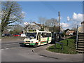
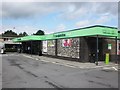
Residents of BS49 4BB enjoy a mix of retail, transport, and leisure options within easy reach. Five retail outlets, including Co-op Yatton and Tesco Congresbury, provide everyday shopping needs. The area’s four railway stations connect to Bristol and surrounding towns, while two airports (Bristol Airport) and a ferry at Clevedon Pier offer regional travel. Though the area is small, its proximity to Yatton and nearby villages ensures a range of services. The presence of multiple rail links and airports makes it convenient for commuters and travelers. While the data does not detail parks or recreational spaces, the historical landscape of the North Somerset Levels suggests natural areas for walking or outdoor activities. The combination of practical amenities and transport links supports a lifestyle that balances rural tranquillity with urban accessibility.
Amenities
Schools
Residents of BS49 4BB have access to two primary schools: Yatton Voluntary Controlled Infant School, a traditional state-funded primary, and Yatton Infant School, an academy with an Ofsted rating of “good.” Both institutions cater to younger children, providing families with options between a maintained school and a more autonomous academy. The presence of two schools in close proximity suggests a well-served educational environment for primary-age children, though no secondary schools are listed in the data. The mix of school types allows parents to choose between a conventional state school or an academy, which may offer distinct curricula or governance models. However, the absence of secondary education options within the area means students would need to travel to nearby towns for further schooling.
| Rank | School | Type | Entry gender | Ages |
|---|
Explore more schools in this area
Go to Schools tabDemographics
BS49 4BB has a median age of 47, with the most common age range being adults aged 30–64. This suggests a mature, stable population, likely with established careers and families. Home ownership is high at 84%, indicating a community of long-term residents rather than transient renters. The accommodation type is predominantly houses, reflecting a traditional, low-density housing stock. The predominant ethnic group is White, though no specific data on diversity or deprivation is provided. The age profile implies a mix of professionals and retirees, with limited presence of younger families or students. This demographic structure may influence local services and amenities, which are tailored to adult needs rather than those of children or younger residents. The lack of data on diversity or deprivation means the area’s social composition remains largely unexplored in public records.
Household Size
Accommodation Type
Tenure
Ethnic Group
Religion
Household Composition
Age
Household Deprivation
NS-SEC
Explore more demographic insights in this area
Go to Demographics tabPlanning
Planning Constraints
- Flood RiskPremium
- Ramsar Wetland SitesPremium
- Area of Outstanding Natural BeautyPremium
- Protected Nature ReservePremium
- Protected WoodlandPremium