Area Overview for BS48 4SG
Photos of BS48 4SG
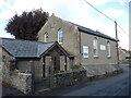
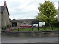
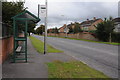
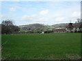
24 photos from this area
Area Information
Key information about the BS48 4SG including its size, population, and administrative classification.
- Area Type
- Postcode
- Area Size
- 7125 m²
- Population
- 1542
- Population Density
- 1486 people/km²
House Prices in BS48 4SG
27
Properties
£219,118
Average Sold Price
£71,000
Lowest Price
£390,000
Highest Price
Showing 27 properties
| Address | Type | Beds | Baths | Last Sale Price | Last Sale Date | |
|---|---|---|---|---|---|---|
| 27 Earlesfield, Nailsea, BS48 4SG | Terraced | 1 | 1 | £230,000 | Jul 2025 | |
| 34 Earlesfield, Nailsea, BS48 4SG | Terraced | 2 | 1 | £275,000 | May 2025 | |
| 48 Earlesfield, Nailsea, BS48 4SG | Bungalow | - | - | £325,000 | Aug 2024 | |
| 49 Earlesfield, Nailsea, BS48 4SG | Bungalow | - | - | £390,000 | Apr 2024 | |
| 25 Earlesfield, Nailsea, BS48 4SG | house | 1 | 1 | £233,000 | May 2023 | |
| 37 Earlesfield, Nailsea, BS48 4SG | Terraced | 2 | 1 | £272,500 | Mar 2023 | |
| 30 Earlesfield, Nailsea, BS48 4SG | Terraced | 2 | 1 | £279,995 | Nov 2022 | |
| 36 Earlesfield, Nailsea, BS48 4SG | Terraced | 2 | 1 | £235,000 | Jun 2022 | |
| 29 Earlesfield, Nailsea, BS48 4SG | house | - | - | £219,000 | Feb 2022 | |
| 39 Earlesfield, Nailsea, BS48 4SG | house | - | - | £250,000 | Aug 2021 |
Page 1 of 3
Energy Efficiency in BS48 4SG
Amenities
Schools
| Rank | School | Type | Entry gender | Ages |
|---|
Explore more schools in this area
Go to Schools tabDemographics
Household Size
Two person
most common
Accommodation Type
Houses
most common
Tenure
68
majority
Ethnic Group
White
most common
Religion
N/A
most common
Household Composition
N/A
most common
Age
47
median
Adults (30-64 years)
most common
Household Deprivation
N/A
with no deprivation
NS-SEC
36
in Lower managerial occupations
Explore more demographic insights in this area
Go to Demographics tabPlanning
Planning Constraints
- Flood RiskPremium
- Ramsar Wetland SitesPremium
- Area of Outstanding Natural BeautyPremium
- Protected Nature ReservePremium
- Protected WoodlandPremium