Area Overview for BS48 4FE
Photos of BS48 4FE


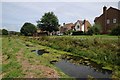
19 photos from this area
Area Information
Key information about the BS48 4FE including its size, population, and administrative classification.
- Area Type
- Postcode
- Area Size
- 4946 m²
- Population
- 1542
- Population Density
- 1486 people/km²
House Prices in BS48 4FE
9
Properties
£442,500
Average Sold Price
£101,500
Lowest Price
£1,050,000
Highest Price
Showing 9 properties
| Address | Type | Beds | Baths | Last Sale Price | Last Sale Date | |
|---|---|---|---|---|---|---|
| Ashmead, Barnwood Court, Nailsea, BS48 4FE | house | - | - | £1,050,000 | Apr 2024 | |
| Hally House, Barnwood Court, Nailsea, BS48 4FE | Detached | 4 | 2 | £660,000 | Nov 2023 | |
| Blenheim, Barnwood Court, Nailsea, BS48 4FE | house | - | - | £250,000 | Feb 2006 | |
| Orchard End, Barnwood Court, Nailsea, BS48 4FE | Detached | - | - | £151,000 | Sep 1999 | |
| Lambourne House, Barnwood Court, Nailsea, BS48 4FE | Detached | - | - | £101,500 | Dec 1996 | |
| Russett House, Barnwood Court, Nailsea, BS48 4FE | Detached | - | - | - | - | |
| Bramley, Barnwood Court, Nailsea, BS48 4FE | Detached | - | - | - | - | |
| Olive House, Barnwood Court, Nailsea, BS48 4FE | Bungalow | 3 | 2 | - | - | |
| Bonaire, Barnwood Court, Nailsea, BS48 4FE | house | - | - | - | - |
Energy Efficiency in BS48 4FE
Amenities
Schools
| Rank | School | Type | Entry gender | Ages |
|---|
Explore more schools in this area
Go to Schools tabDemographics
Household Size
Two person
most common
Accommodation Type
Houses
most common
Tenure
68
majority
Ethnic Group
White
most common
Religion
N/A
most common
Household Composition
N/A
most common
Age
47
median
Adults (30-64 years)
most common
Household Deprivation
N/A
with no deprivation
NS-SEC
36
in Lower managerial occupations
Explore more demographic insights in this area
Go to Demographics tabPlanning
Planning Constraints
- Flood RiskPremium
- Ramsar Wetland SitesPremium
- Area of Outstanding Natural BeautyPremium
- Protected Nature ReservePremium
- Protected WoodlandPremium