Area Overview for BS48 3SG
Photos of BS48 3SG

Area Information
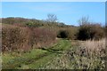
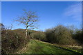
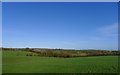
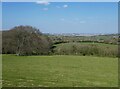
BS48 3SG is a small, semi-rural postcode area nestled in the village of Barrow Gurney, Somerset, approximately 5 miles south-west of Bristol city centre. With a population of 1,484 and a density of 116 people per square kilometre, it reflects a compact, close-knit community. The area is defined by its picturesque character, including a village green, meandering stream, and remnants of historical features like pre-Domesday mills. Its location on the B3130, midway between the A38 and A370, places it near the Long Ashton bypass and Bristol Airport, offering commuters a strategic position. Despite its rural charm, the area is not isolated: it connects to nearby towns via rail stations and ferry landings. The village’s narrow roads, while traffic-calmed, serve as a local shortcut to Bristol Airport, blending practicality with a historic, low-key atmosphere. For those seeking a peaceful yet accessible lifestyle, BS48 3SG combines rural tranquillity with proximity to urban amenities, making it a distinctive choice for buyers prioritising both scenery and connectivity.
- Area Type
- Postcode
- Area Size
- Not available
- Population
- 1484
- Population Density
- 116 people/km²
The property market in BS48 3SG is dominated by owner-occupied homes, with 85% of properties owned by residents rather than rented. This high ownership rate suggests a stable, long-term community with limited turnover. The accommodation type is primarily houses, which is typical for semi-rural areas where larger properties are preferred. Given the small size of the postcode area and its classification as a residential cluster, the housing stock is likely limited in volume, making it a niche market for buyers seeking characterful, low-density living. The focus on houses rather than flats or apartments aligns with the area’s rural appeal, though the limited supply could mean competition for available properties. Buyers should consider the area’s proximity to Bristol for work opportunities, balancing the charm of semi-rural life with urban accessibility.
House Prices in BS48 3SG
No properties found in this postcode.
Energy Efficiency in BS48 3SG
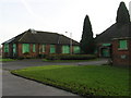
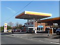
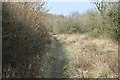
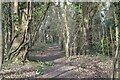
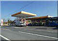
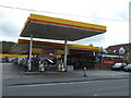
Living in BS48 3SG offers a blend of rural charm and practical amenities. The village green, stream, and historic sites like the Church of St Mary and St Edward provide scenic spaces for leisure. Retail options include Co-op Long and Morrisons Daily, catering to daily needs. The narrow roads, while traffic-calmed, serve as a local shortcut to Bristol Airport, adding to the area’s accessibility. Nearby rail stations and ferry landings enhance mobility, while the proximity to Bristol ensures access to urban facilities. The presence of two pubs and wooded countryside contributes to a community-focused lifestyle. For those valuing both tranquillity and connectivity, the area’s amenities offer a balance, though residents may need to travel for more specialised services. The semi-rural setting, combined with nearby infrastructure, makes it appealing for those seeking a relaxed yet functional environment.
Amenities
Schools
The nearest schools to BS48 3SG include Flax Bourton Church of England Primary School, a primary school serving the local community. While only one school type is listed, its presence indicates a focus on early education for families in the area. The lack of secondary schools nearby suggests that students may need to travel to adjacent towns for higher education. For parents prioritising faith-based education, the Church of England designation may be a key factor. However, the absence of data on Ofsted ratings or school performance means prospective families should investigate further to assess quality. The availability of a primary school supports the area’s appeal to families, though the need for additional schooling options beyond primary level is a practical consideration.
| Rank | School | Type | Entry gender | Ages |
|---|
Explore more schools in this area
Go to Schools tabDemographics
The demographic profile of BS48 3SG is shaped by a median age of 47, with the majority of residents aged 30–64. This suggests a mature, stable population, likely with established careers and family ties. Home ownership is high at 85%, indicating a community of long-term residents rather than transient renters. The predominant accommodation type is houses, reflecting a preference for private, detached living. The predominant ethnic group is White, aligning with broader regional trends. The absence of specific data on deprivation or diversity means the area’s social dynamics remain largely unexamined, but the high home ownership rate and age profile imply a focus on comfort and security over rapid change. For families or professionals seeking a settled environment, this demographic structure offers predictability and a sense of continuity.
Household Size
Accommodation Type
Tenure
Ethnic Group
Religion
Household Composition
Age
Household Deprivation
NS-SEC
Explore more demographic insights in this area
Go to Demographics tabPlanning
Planning Constraints
- Flood RiskPremium
- Ramsar Wetland SitesPremium
- Area of Outstanding Natural BeautyPremium
- Protected Nature ReservePremium
- Protected WoodlandPremium