Area Overview for BS48 3PD
Photos of BS48 3PD
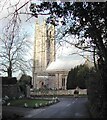
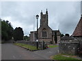
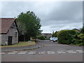
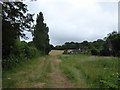
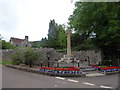
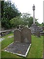
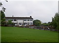
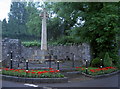
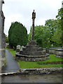

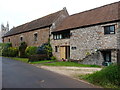
47 photos from this area
Area Information
Key information about the BS48 3PD including its size, population, and administrative classification.
- Area Type
- Postcode
- Area Size
- 7.2 hectares
- Population
- 1584
- Population Density
- 132 people/km²
House Prices in BS48 3PD
22
Properties
£598,791
Average Sold Price
£92,000
Lowest Price
£1,650,000
Highest Price
Showing 22 properties
| Address | Type | Beds | Baths | Last Sale Price | Last Sale Date | |
|---|---|---|---|---|---|---|
| 92 Farleigh Road, Backwell, BS48 3PD | Bungalow | - | - | £585,000 | Jan 2025 | |
| 78 Farleigh Road, Backwell, BS48 3PD | house | 4 | 2 | £718,000 | Nov 2024 | |
| 68 Farleigh Road, Backwell, BS48 3PD | Detached | 5 | - | £950,000 | Apr 2024 | |
| Firleaze, 54 Farleigh Road, Backwell, BS48 3PD | Detached | - | - | £1,600,000 | Jan 2024 | |
| Fieldings, 56 Farleigh Road, Backwell, BS48 3PD | Detached | - | - | £1,650,000 | Jan 2024 | |
| 60 Farleigh Road, Backwell, BS48 3PD | Retail | 5 | 1 | £685,000 | Feb 2022 | |
| 66 Farleigh Road, Backwell, BS48 3PD | house | - | - | £730,000 | Oct 2018 | |
| 62 Farleigh Road, Backwell, BS48 3PD | house | - | - | £614,150 | Apr 2015 | |
| 82 Farleigh Road, Backwell, BS48 3PD | house | 3 | - | £350,000 | Apr 2012 | |
| 64 Farleigh Road, Backwell, BS48 3PD | Detached | - | - | £541,000 | Mar 2008 |
Page 1 of 3
Energy Efficiency in BS48 3PD
Amenities
Schools
| Rank | School | Type | Entry gender | Ages |
|---|
Explore more schools in this area
Go to Schools tabDemographics
Household Size
Two person
most common
Accommodation Type
Houses
most common
Tenure
82
majority
Ethnic Group
White
most common
Religion
N/A
most common
Household Composition
N/A
most common
Age
47
median
Adults (30-64 years)
most common
Household Deprivation
N/A
with no deprivation
NS-SEC
48
in Lower managerial occupations
Explore more demographic insights in this area
Go to Demographics tabPlanning
Planning Constraints
- Flood RiskPremium
- Ramsar Wetland SitesPremium
- Area of Outstanding Natural BeautyPremium
- Protected Nature ReservePremium
- Protected WoodlandPremium