Area Overview for BS48 3NQ
Photos of BS48 3NQ
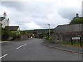
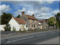
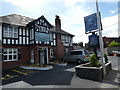
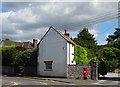
58 photos from this area
Area Information
Key information about the BS48 3NQ including its size, population, and administrative classification.
- Area Type
- Postcode
- Area Size
- 9565 m²
- Population
- 1523
- Population Density
- 1741 people/km²
House Prices in BS48 3NQ
20
Properties
£280,519
Average Sold Price
£78,000
Lowest Price
£535,000
Highest Price
Showing 20 properties
| Address | Type | Beds | Baths | Last Sale Price | Last Sale Date | |
|---|---|---|---|---|---|---|
| 14 Westfield Close, Backwell, BS48 3NQ | Semi-detached | 3 | 2 | £420,000 | Mar 2025 | |
| 15 Westfield Close, Backwell, BS48 3NQ | Semi-detached | 4 | 2 | £535,000 | Dec 2023 | |
| 18 Westfield Close, Backwell, BS48 3NQ | house | - | - | £277,500 | Mar 2018 | |
| 8 Westfield Close, Backwell, BS48 3NQ | Semi-detached | 2 | 1 | £340,000 | Dec 2017 | |
| 17 Westfield Close, Backwell, BS48 3NQ | house | 3 | 1 | £280,000 | Jul 2017 | |
| 20 Westfield Close, Backwell, BS48 3NQ | house | - | - | £300,000 | Mar 2017 | |
| 16 Westfield Close, Backwell, BS48 3NQ | Semi-detached | 3 | 2 | £308,250 | Nov 2015 | |
| 11 Westfield Close, Backwell, BS48 3NQ | house | - | - | £346,000 | Oct 2015 | |
| 2 Westfield Close, Backwell, BS48 3NQ | Semi-detached | 3 | 1 | £255,000 | Sep 2014 | |
| 3 Westfield Close, Backwell, BS48 3NQ | Semi-detached | 3 | - | £235,000 | Jun 2014 |
Page 1 of 2
Energy Efficiency in BS48 3NQ
Amenities
Schools
| Rank | School | Type | Entry gender | Ages |
|---|
Explore more schools in this area
Go to Schools tabDemographics
Household Size
Family (3-5 people)
most common
Accommodation Type
Houses
most common
Tenure
75
majority
Ethnic Group
White
most common
Religion
N/A
most common
Household Composition
N/A
most common
Age
47
median
Adults (30-64 years)
most common
Household Deprivation
N/A
with no deprivation
NS-SEC
41
in Lower managerial occupations
Explore more demographic insights in this area
Go to Demographics tabPlanning
Planning Constraints
- Flood RiskPremium
- Ramsar Wetland SitesPremium
- Area of Outstanding Natural BeautyPremium
- Protected Nature ReservePremium
- Protected WoodlandPremium