Area Overview for BS48 3NE
Photos of BS48 3NE
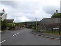
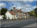
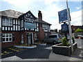
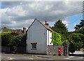
58 photos from this area
Area Information
Key information about the BS48 3NE including its size, population, and administrative classification.
- Area Type
- Postcode
- Area Size
- 1.4 hectares
- Population
- 1523
- Population Density
- 1741 people/km²
House Prices in BS48 3NE
32
Properties
£188,374
Average Sold Price
£26,040
Lowest Price
£362,000
Highest Price
Showing 32 properties
| Address | Type | Beds | Baths | Last Sale Price | Last Sale Date | |
|---|---|---|---|---|---|---|
| 18 Westfield Road, Backwell, BS48 3NE | Semi-detached | 3 | 1 | £270,000 | May 2024 | |
| 8 Westfield Road, Backwell, BS48 3NE | Semi-detached | 3 | - | £362,000 | Aug 2022 | |
| 11 Westfield Road, Backwell, BS48 3NE | Semi-detached | 3 | 2 | £225,000 | Jun 2020 | |
| 27 Westfield Road, Backwell, BS48 3NE | house | - | - | £197,000 | Oct 2013 | |
| 5 Westfield Road, Backwell, BS48 3NE | Semi-detached | 2 | - | £197,500 | Sep 2013 | |
| 29 Westfield Road, Backwell, BS48 3NE | Semi-detached | - | - | £213,000 | Feb 2012 | |
| 25 Westfield Road, Backwell, BS48 3NE | Semi-detached | - | - | £202,000 | Jul 2006 | |
| 21 Westfield Road, Backwell, BS48 3NE | Semi-detached | 3 | 2 | £115,000 | Jul 2002 | |
| 9 Westfield Road, Backwell, BS48 3NE | Semi-detached | - | - | £76,200 | Jun 2000 | |
| 7 Westfield Road, Backwell, BS48 3NE | house | - | - | £26,040 | Dec 1996 |
Page 1 of 4
Energy Efficiency in BS48 3NE
Amenities
Schools
| Rank | School | Type | Entry gender | Ages |
|---|
Explore more schools in this area
Go to Schools tabDemographics
Household Size
Family (3-5 people)
most common
Accommodation Type
Houses
most common
Tenure
75
majority
Ethnic Group
White
most common
Religion
N/A
most common
Household Composition
N/A
most common
Age
47
median
Adults (30-64 years)
most common
Household Deprivation
N/A
with no deprivation
NS-SEC
41
in Lower managerial occupations
Explore more demographic insights in this area
Go to Demographics tabPlanning
Planning Constraints
- Flood RiskPremium
- Ramsar Wetland SitesPremium
- Area of Outstanding Natural BeautyPremium
- Protected Nature ReservePremium
- Protected WoodlandPremium