Area Overview for BS48 3JZ
Photos of BS48 3JZ
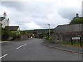
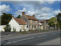
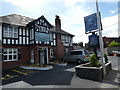
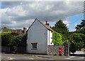
58 photos from this area
Area Information
Key information about the BS48 3JZ including its size, population, and administrative classification.
- Area Type
- Postcode
- Area Size
- 7.6 hectares
- Population
- 1608
- Population Density
- 739 people/km²
House Prices in BS48 3JZ
39
Properties
£322,152
Average Sold Price
£73,500
Lowest Price
£690,000
Highest Price
Showing 39 properties
| Address | Type | Beds | Baths | Last Sale Price | Last Sale Date | |
|---|---|---|---|---|---|---|
| 24 Hilldale Road, Backwell, BS48 3JZ | house | - | - | £690,000 | Sep 2023 | |
| 28 Hilldale Road, Backwell, BS48 3JZ | house | - | - | £657,000 | Dec 2022 | |
| 25 Hilldale Road, Backwell, BS48 3JZ | Semi-detached | 3 | 1 | £575,000 | Nov 2022 | |
| 47 Hilldale Road, Backwell, BS48 3JZ | house | - | - | £515,000 | Jan 2021 | |
| 29 Hilldale Road, Backwell, BS48 3JZ | Semi-detached | 4 | 1 | £448,000 | Aug 2020 | |
| 38 Hilldale Road, Backwell, BS48 3JZ | Detached | 6 | 3 | £624,000 | Sep 2018 | |
| 8 Hilldale Road, Backwell, BS48 3JZ | house | - | - | £393,250 | Jun 2018 | |
| 27 Hilldale Road, Backwell, BS48 3JZ | Semi-detached | 3 | - | £340,000 | Aug 2016 | |
| 19 Hilldale Road, Backwell, BS48 3JZ | house | - | - | £361,000 | Jun 2016 | |
| 33 Hilldale Road, Backwell, BS48 3JZ | house | - | - | £292,000 | Oct 2015 |
Page 1 of 4
Energy Efficiency in BS48 3JZ
Amenities
Schools
| Rank | School | Type | Entry gender | Ages |
|---|
Explore more schools in this area
Go to Schools tabDemographics
Household Size
Family (3-5 people)
most common
Accommodation Type
Houses
most common
Tenure
93
majority
Ethnic Group
White
most common
Religion
N/A
most common
Household Composition
N/A
most common
Age
47
median
Adults (30-64 years)
most common
Household Deprivation
N/A
with no deprivation
NS-SEC
53
in Lower managerial occupations
Explore more demographic insights in this area
Go to Demographics tabPlanning
Planning Constraints
- Flood RiskPremium
- Ramsar Wetland SitesPremium
- Area of Outstanding Natural BeautyPremium
- Protected Nature ReservePremium
- Protected WoodlandPremium