Area Overview for BS48 3DN
Photos of BS48 3DN
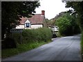


79 photos from this area
Area Information
Key information about the BS48 3DN including its size, population, and administrative classification.
- Area Type
- Postcode
- Area Size
- 31.7 hectares
- Population
- 1410
- Population Density
- 53 people/km²
House Prices in BS48 3DN
15
Properties
£308,400
Average Sold Price
£160,000
Lowest Price
£475,000
Highest Price
Showing 15 properties
| Address | Type | Beds | Baths | Last Sale Price | Last Sale Date | |
|---|---|---|---|---|---|---|
| Sunny Rocks, Downside Road, Backwell, BS48 3DN | Bungalow | 4 | - | £350,000 | Apr 2015 | |
| Woodham House, Downside Road, Backwell, BS48 3DN | Detached | 2 | 2 | £310,000 | Apr 2007 | |
| Lime Kiln Cottage, Downside Road, Backwell, BS48 3DN | Detached | - | - | £475,000 | Jan 2007 | |
| Stoneleigh, Downside Road, Backwell, BS48 3DN | house | - | - | £247,000 | Jul 2001 | |
| The Old Chaff Mills, Downside Road, Backwell, BS48 3DN | Detached | - | - | £160,000 | Jan 1997 | |
| Fairfield, Downside Road, Backwell, BS48 3DN | house | - | - | - | - | |
| Melody Cottage, Downside Road, Backwell, BS48 3DN | Land | - | - | - | - | |
| 4, Downside Estate, Downside Road, Backwell, BS48 3DN | Semi-detached | - | - | - | - | |
| 1, Downside Estate, Downside Road, Backwell, BS48 3DN | house | - | - | - | - | |
| Garage Flat, Old Farm, Downside Road, Backwell, BS48 3DN | Flat | - | - | - | - |
Page 1 of 2
Energy Efficiency in BS48 3DN
Amenities
Schools
| Rank | School | Type | Entry gender | Ages |
|---|
Explore more schools in this area
Go to Schools tabDemographics
Household Size
Two person
most common
Accommodation Type
Houses
most common
Tenure
86
majority
Ethnic Group
White
most common
Religion
N/A
most common
Household Composition
N/A
most common
Age
47
median
Adults (30-64 years)
most common
Household Deprivation
N/A
with no deprivation
NS-SEC
47
in Lower managerial occupations
Explore more demographic insights in this area
Go to Demographics tabPlanning
Planning Constraints
- Flood RiskPremium
- Ramsar Wetland SitesPremium
- Area of Outstanding Natural BeautyPremium
- Protected Nature ReservePremium
- Protected WoodlandPremium