Area Overview for BS48 3AJ
Photos of BS48 3AJ

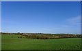
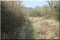
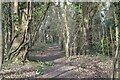
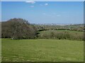
28 photos from this area
Area Information
Key information about the BS48 3AJ including its size, population, and administrative classification.
- Area Type
- Postcode
- Area Size
- 21.4 hectares
- Population
- 1484
- Population Density
- 116 people/km²
House Prices in BS48 3AJ
10
Properties
£607,011
Average Sold Price
£11,113
Lowest Price
£1,225,000
Highest Price
Showing 10 properties
| Address | Type | Beds | Baths | Last Sale Price | Last Sale Date | |
|---|---|---|---|---|---|---|
| 8 Clover Grove, Barrow Gurney, BS48 3AJ | Detached | 6 | 5 | £1,225,000 | Jul 2024 | |
| 9 Clover Grove, Barrow Gurney, BS48 3AJ | Retail | 5 | 4 | £1,225,000 | Mar 2022 | |
| 1 Clover Grove, Barrow Gurney, BS48 3AJ | house | - | - | £1,025,000 | Sep 2021 | |
| 2 Clover Grove, Barrow Gurney, BS48 3AJ | Detached | 4 | 3 | £33,102 | May 2021 | |
| 5 Clover Grove, Barrow Gurney, BS48 3AJ | house | - | - | £16,048 | May 2021 | |
| 3 Clover Grove, Barrow Gurney, BS48 3AJ | house | - | - | £11,113 | May 2021 | |
| 4 Clover Grove, Barrow Gurney, BS48 3AJ | house | - | - | £12,096 | May 2021 | |
| 6 Clover Grove, Barrow Gurney, BS48 3AJ | house | - | - | £960,000 | Jul 2019 | |
| 7 Clover Grove, Barrow Gurney, BS48 3AJ | house | - | - | £752,750 | Jun 2018 | |
| 10 Clover Grove, Barrow Gurney, BS48 3AJ | Detached | 5 | 4 | £810,000 | Jun 2018 |
Energy Efficiency in BS48 3AJ
Amenities
Schools
| Rank | School | Type | Entry gender | Ages |
|---|
Explore more schools in this area
Go to Schools tabDemographics
Household Size
Family (3-5 people)
most common
Accommodation Type
Houses
most common
Tenure
85
majority
Ethnic Group
White
most common
Religion
N/A
most common
Household Composition
N/A
most common
Age
47
median
Adults (30-64 years)
most common
Household Deprivation
N/A
with no deprivation
NS-SEC
52
in Lower managerial occupations
Explore more demographic insights in this area
Go to Demographics tabPlanning
Planning Constraints
- Flood RiskPremium
- Ramsar Wetland SitesPremium
- Area of Outstanding Natural BeautyPremium
- Protected Nature ReservePremium
- Protected WoodlandPremium