Area Overview for BS48 3AD
Photos of BS48 3AD
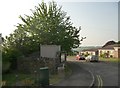
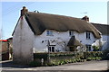
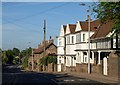
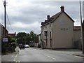
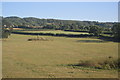

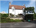
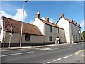
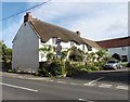
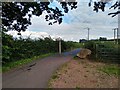
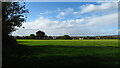
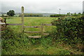
40 photos from this area
Area Information
Key information about the BS48 3AD including its size, population, and administrative classification.
- Area Type
- Postcode
- Area Size
- 38.5 hectares
- Population
- 1608
- Population Density
- 739 people/km²
House Prices in BS48 3AD
16
Properties
£492,233
Average Sold Price
£80,000
Lowest Price
£1,075,000
Highest Price
Showing 16 properties
| Address | Type | Beds | Baths | Last Sale Price | Last Sale Date | |
|---|---|---|---|---|---|---|
| Rivida Cottage, 12 Backwell Common, Backwell, BS48 3AD | house | 5 | 3 | £1,075,000 | Oct 2024 | |
| 4, Russetts Cottages, Backwell Common, Backwell, BS48 3AD | Terraced | - | - | £290,000 | Jan 2021 | |
| 3, Russetts Cottages, Backwell Common, Backwell, BS48 3AD | house | - | - | £353,400 | Mar 2019 | |
| Cider Farm, Backwell Common, Backwell, BS48 3AD | Detached | 5 | 3 | £795,000 | Jul 2014 | |
| Willow Cottage, Backwell Common, Backwell, BS48 3AD | Semi-detached | - | - | £360,000 | Mar 2007 | |
| 2, Russetts Cottages, Backwell Common, Backwell, BS48 3AD | Terraced | - | - | £80,000 | Jul 1995 | |
| Pentargan, Backwell Common, Backwell, BS48 3AD | Detached | 5 | 3 | - | - | |
| Cider House, Backwell Common, Backwell, BS48 3AD | Detached | 4 | - | - | - | |
| 5, Russetts Cottages, Backwell Common, Backwell, BS48 3AD | Terraced | - | - | - | - | |
| Unit 2, Cider Barn, Backwell Common, Backwell, BS48 3AD | Detached | 2 | - | - | - |
Page 1 of 2
Energy Efficiency in BS48 3AD
Amenities
Schools
| Rank | School | Type | Entry gender | Ages |
|---|
Explore more schools in this area
Go to Schools tabDemographics
Household Size
Family (3-5 people)
most common
Accommodation Type
Houses
most common
Tenure
93
majority
Ethnic Group
White
most common
Religion
N/A
most common
Household Composition
N/A
most common
Age
47
median
Adults (30-64 years)
most common
Household Deprivation
N/A
with no deprivation
NS-SEC
53
in Lower managerial occupations
Explore more demographic insights in this area
Go to Demographics tabPlanning
Planning Constraints
- Flood RiskPremium
- Ramsar Wetland SitesPremium
- Area of Outstanding Natural BeautyPremium
- Protected Nature ReservePremium
- Protected WoodlandPremium