Area Overview for BS48 1ND
Photos of BS48 1ND
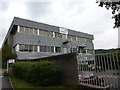
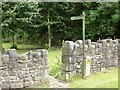
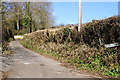
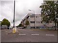
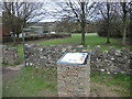
43 photos from this area
Area Information
Key information about the BS48 1ND including its size, population, and administrative classification.
- Area Type
- Postcode
- Area Size
- 31.3 hectares
- Population
- 1653
- Population Density
- 111 people/km²
House Prices in BS48 1ND
60
Properties
£384,066
Average Sold Price
£125,000
Lowest Price
£835,000
Highest Price
Showing 60 properties
| Address | Type | Beds | Baths | Last Sale Price | Last Sale Date | |
|---|---|---|---|---|---|---|
| 47 Green Pastures Road, Wraxall, BS48 1ND | Detached | 4 | 3 | £835,000 | Sep 2025 | |
| 15 Green Pastures Road, Wraxall, BS48 1ND | house | - | - | £713,500 | Jan 2025 | |
| 32 Green Pastures Road, Wraxall, BS48 1ND | Detached | 4 | 2 | £610,000 | Nov 2024 | |
| 11 Green Pastures Road, Wraxall, BS48 1ND | Detached | 4 | 2 | £645,000 | May 2024 | |
| 22 Green Pastures Road, Wraxall, BS48 1ND | house | 4 | 2 | £660,000 | Nov 2023 | |
| 27 Green Pastures Road, Wraxall, BS48 1ND | house | - | - | £775,000 | Nov 2023 | |
| 48 Green Pastures Road, Wraxall, BS48 1ND | Detached | 4 | 2 | £650,000 | Jun 2023 | |
| 14 Green Pastures Road, Wraxall, BS48 1ND | house | - | - | £530,000 | Feb 2021 | |
| 50 Green Pastures Road, Wraxall, BS48 1ND | house | 4 | - | £665,000 | Dec 2020 | |
| 40 Green Pastures Road, Wraxall, BS48 1ND | house | - | - | £510,000 | Nov 2020 |
Page 1 of 6
Energy Efficiency in BS48 1ND
Amenities
Schools
| Rank | School | Type | Entry gender | Ages |
|---|
Explore more schools in this area
Go to Schools tabDemographics
Household Size
Family (3-5 people)
most common
Accommodation Type
Houses
most common
Tenure
83
majority
Ethnic Group
White
most common
Religion
N/A
most common
Household Composition
N/A
most common
Age
47
median
Adults (30-64 years)
most common
Household Deprivation
N/A
with no deprivation
NS-SEC
49
in Lower managerial occupations
Explore more demographic insights in this area
Go to Demographics tabPlanning
Planning Constraints
- Flood RiskPremium
- Ramsar Wetland SitesPremium
- Area of Outstanding Natural BeautyPremium
- Protected Nature ReservePremium
- Protected WoodlandPremium