Area Overview for BS48 1LQ
Photos of BS48 1LQ
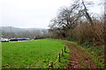
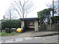
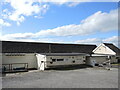
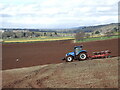
74 photos from this area
Area Information
Key information about the BS48 1LQ including its size, population, and administrative classification.
- Area Type
- Postcode
- Area Size
- 20.9 hectares
- Population
- 1653
- Population Density
- 111 people/km²
House Prices in BS48 1LQ
18
Properties
£390,500
Average Sold Price
£87,000
Lowest Price
£660,000
Highest Price
Showing 18 properties
| Address | Type | Beds | Baths | Last Sale Price | Last Sale Date | |
|---|---|---|---|---|---|---|
| 21, Bankside Cottages, Bristol Road, Wraxall, BS48 1LQ | Semi-detached | 4 | - | £515,000 | Dec 2015 | |
| Rock Farm, Bristol Road, Wraxall, BS48 1LQ | house | - | - | £660,000 | Apr 2013 | |
| Woodcroft, Bristol Road, Wraxall, BS48 1LQ | house | - | - | £300,000 | Jan 2002 | |
| Said House, Bristol Road, Wraxall, BS48 1LQ | house | - | - | £87,000 | Mar 1998 | |
| The Boots, Bristol Road, Wraxall, BS48 1LQ | Detached | 2 | - | - | - | |
| Top Flat, New Battleaxes, Bristol Road, Wraxall, BS48 1LQ | Flat | - | - | - | - | |
| First Floor Flat, Battle Axe Cottage, Bristol Road, Wraxall, BS48 1LQ | Flat | - | - | - | - | |
| Farm House, Hazel Farm, Bristol Road, Wraxall, BS48 1LQ | Detached | - | - | - | - | |
| Ground Floor Flat, Battle Axe Cottage, Bristol Road, Wraxall, BS48 1LQ | Flat | - | - | - | - | |
| Hazel Farm, Bristol Road, Wraxall, BS48 1LQ | Farm | - | - | - | - |
Page 1 of 2
Energy Efficiency in BS48 1LQ
Amenities
Schools
| Rank | School | Type | Entry gender | Ages |
|---|
Explore more schools in this area
Go to Schools tabDemographics
Household Size
Family (3-5 people)
most common
Accommodation Type
Houses
most common
Tenure
83
majority
Ethnic Group
White
most common
Religion
N/A
most common
Household Composition
N/A
most common
Age
47
median
Adults (30-64 years)
most common
Household Deprivation
N/A
with no deprivation
NS-SEC
49
in Lower managerial occupations
Explore more demographic insights in this area
Go to Demographics tabPlanning
Planning Constraints
- Flood RiskPremium
- Ramsar Wetland SitesPremium
- Area of Outstanding Natural BeautyPremium
- Protected Nature ReservePremium
- Protected WoodlandPremium