Area Overview for BS41 9YD
Photos of BS41 9YD

Area Information
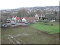
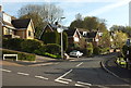
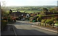
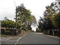
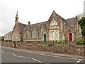
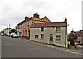
BS41 9YD is a small residential postcode area in England, encompassing a compact cluster of homes near the historic village of Long Ashton. With a population of 2,172 and a density of 452 people per square kilometre, this area strikes a balance between rural tranquillity and proximity to urban amenities. Long Ashton itself, part of North Somerset, has roots in Saxon times and is marked by its straggling layout along main roads, with brooks like Longmoor Brook shaping its character. Residents here benefit from a mature demographic, with a median age of 47, suggesting a community of long-term residents. The area’s compact size means daily life is defined by local shops, transport links, and a low crime rate. Living in BS41 9YD offers a blend of historical charm and modern convenience, with nearby attractions such as the River Avon and Ashton Court Estate. For those seeking a stable, low-risk environment with access to essential services, this postcode provides a snapshot of traditional English village life with practical connectivity to Bristol and surrounding areas.
- Area Type
- Postcode
- Area Size
- Not available
- Population
- 2172
- Population Density
- 452 people/km²
The property market in BS41 9YD is dominated by owner-occupied homes, with 83% of properties owned outright. This high rate of home ownership suggests a stable, long-term resident base with little turnover. The accommodation type is predominantly houses, which is typical for smaller, rural postcodes where land availability supports larger properties. This contrasts with urban areas where flats or terraced housing are more common. For buyers, the small size of the area means the housing stock is limited, and properties are likely to be in established, older homes rather than new developments. The low population density and focus on houses indicate a market suited to families or individuals seeking space and privacy. However, the limited number of properties also means competition may be fierce, and buyers should consider proximity to nearby towns like Bristol for additional options.
House Prices in BS41 9YD
No properties found in this postcode.
Energy Efficiency in BS41 9YD
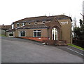
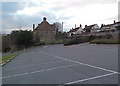
Living in BS41 9YD offers access to a range of amenities within practical reach. Retail options include Co-op Long, Sainsburys Winterstoke, and Iceland South Bristol Retail, providing essential shopping and grocery needs. The area’s proximity to ferry landings like Nova Scotia and Pumphouse adds convenience for those using water transport. Rail stations such as Parson Street and Clifton Down connect residents to Bristol’s broader network, while Bristol Airport offers regional and international travel. The presence of multiple airports and ferry services enhances mobility, though the area’s small size means larger leisure facilities may require travel to nearby towns. The mix of retail, transport, and connectivity options supports a balanced lifestyle, blending local convenience with access to urban amenities.
Amenities
Schools
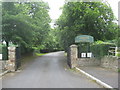
The nearest school to BS41 9YD is Northleaze Church of England Primary School, a primary institution serving the local community. While the data lists the school twice, it appears to be the only educational facility mentioned. As a primary school, it caters to younger children, but families with older children may need to look further afield for secondary education. The absence of secondary schools in the immediate area means parents should consider commuting to nearby towns like Bristol or Bath for higher-level schooling. The school’s presence, however, supports the area’s appeal to families seeking a safe, community-focused environment. The lack of additional schools highlights a potential limitation for households requiring a full range of educational options within walking distance.
| Rank | School | Type | Entry gender | Ages |
|---|
Explore more schools in this area
Go to Schools tabDemographics
The community in BS41 9YD is predominantly composed of adults aged 30–64, with a median age of 47. This suggests a mature, established population, likely with strong ties to the area. Home ownership is high at 83%, indicating a stable housing market where most residents live in their own homes rather than renting. The accommodation type is primarily houses, which aligns with the area’s low population density and rural character. The predominant ethnic group is White, reflecting the demographic profile of many small English villages. While specific data on deprivation is not provided, the high home ownership and low crime rate (Safety Score: 87/100) imply a relatively affluent and secure environment. The absence of significant diversity data means the community’s cultural composition remains largely homogenous, which may influence local social dynamics and services.
Household Size
Accommodation Type
Tenure
Ethnic Group
Religion
Household Composition
Age
Household Deprivation
NS-SEC
Explore more demographic insights in this area
Go to Demographics tabPlanning
Planning Constraints
- Flood RiskPremium
- Ramsar Wetland SitesPremium
- Area of Outstanding Natural BeautyPremium
- Protected Nature ReservePremium
- Protected WoodlandPremium