Area Overview for BS41 9LE
Photos of BS41 9LE
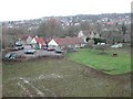
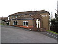
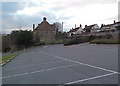
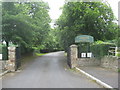
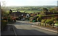
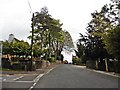
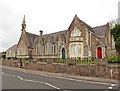
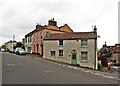
46 photos from this area
Area Information
Key information about the BS41 9LE including its size, population, and administrative classification.
- Area Type
- Postcode
- Area Size
- 1.1 hectares
- Population
- 2172
- Population Density
- 452 people/km²
House Prices in BS41 9LE
13
Properties
£763,148
Average Sold Price
£112,675
Lowest Price
£1,750,000
Highest Price
Showing 13 properties
| Address | Type | Beds | Baths | Last Sale Price | Last Sale Date | |
|---|---|---|---|---|---|---|
| 56 Long Ashton Road, Long Ashton, BS41 9LE | Retail | 4 | 4 | £912,000 | Apr 2024 | |
| 70 Long Ashton Road, Long Ashton, BS41 9LE | house | - | - | £1,750,000 | Sep 2022 | |
| 54 Long Ashton Road, Long Ashton, BS41 9LE | house | - | - | £770,000 | Dec 2021 | |
| 58A Long Ashton Road, Long Ashton, BS41 9LE | Retail | 4 | 4 | £845,000 | Nov 2021 | |
| 58 Long Ashton Road, Long Ashton, BS41 9LE | house | - | - | £835,000 | Nov 2021 | |
| 66 Long Ashton Road, Long Ashton, BS41 9LE | Semi-detached | 4 | 2 | £699,950 | Feb 2021 | |
| 72 Long Ashton Road, Long Ashton, BS41 9LE | house | - | - | £810,000 | Feb 2021 | |
| 70A Long Ashton Road, Long Ashton, BS41 9LE | house | - | - | £855,000 | May 2008 | |
| 64 Long Ashton Road, Long Ashton, BS41 9LE | Terraced | - | - | £555,000 | Nov 2003 | |
| 52 Long Ashton Road, Long Ashton, BS41 9LE | Detached | - | - | £250,000 | Feb 2003 |
Page 1 of 2
Energy Efficiency in BS41 9LE
Amenities
Schools
| Rank | School | Type | Entry gender | Ages |
|---|
Explore more schools in this area
Go to Schools tabDemographics
Household Size
Family (3-5 people)
most common
Accommodation Type
Houses
most common
Tenure
83
majority
Ethnic Group
White
most common
Religion
N/A
most common
Household Composition
N/A
most common
Age
47
median
Adults (30-64 years)
most common
Household Deprivation
N/A
with no deprivation
NS-SEC
56
in Lower managerial occupations
Explore more demographic insights in this area
Go to Demographics tabPlanning
Planning Constraints
- Flood RiskPremium
- Ramsar Wetland SitesPremium
- Area of Outstanding Natural BeautyPremium
- Protected Nature ReservePremium
- Protected WoodlandPremium