Area Overview for BS40 9JR
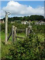
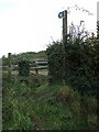
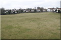
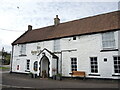
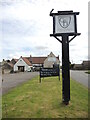
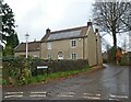
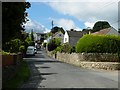
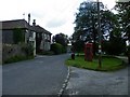
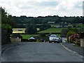
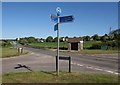
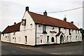
Photos of BS40 9JR
Area Information
BS40 9JR is a small residential postcode area nestled in the rural heart of North Somerset, encompassing the village of Winford and its surrounding hamlets. With a population of 1,399 people and a density of 135 residents per square kilometre, it retains a quiet, community-focused character. The area’s history dates back to the Domesday Book, where it was recorded as *Wenfre*, a name reflecting its medieval origins. Today, it blends historic charm with modern convenience, offering a low-density living environment ideal for those seeking a peaceful yet connected lifestyle. The area is served by multiple rail stations, including Nailsea & Backwell and Bedminster, and is within reach of Bristol Airport, making commuting and travel straightforward. Daily life here is shaped by its proximity to nature, with open spaces and traditional architecture like the 15th-century Church of the Blessed Virgin Mary and St Peter adding to its distinct rural appeal.
- Area Type
- Postcode
- Area Size
- Not available
- Population
- 1399
- Population Density
- 135 people/km²
The property market in BS40 9JR is characterised by high home ownership (83%) and a focus on houses as the primary accommodation type. This suggests a market dominated by owner-occupied homes rather than rental properties, likely appealing to families or individuals seeking long-term stability. The prevalence of houses indicates a preference for larger, private living spaces, which may be rare in more densely populated areas. Given the small size of the postcode area, the housing stock is likely limited, meaning buyers should consider nearby regions for additional options. The high ownership rate also implies a competitive market for existing properties, with limited turnover. For buyers, this environment may offer a sense of community and permanence but could require flexibility in location or property type.
House Prices in BS40 9JR
No properties found in this postcode.
Energy Efficiency in BS40 9JR
The lifestyle in BS40 9JR is shaped by its proximity to a range of amenities. Local retail options include Spar, Morrisons Daily Bristol, and other nearby shops, ensuring daily needs are met without long journeys. The area’s rail stations and ferry landings provide access to leisure and commuting opportunities, while its rural setting offers potential for outdoor activities. The presence of historical sites like the Church of the Blessed Virgin Mary and St Peter adds cultural depth to daily life. Though the data does not specify parks or recreational spaces, the area’s low density suggests opportunities for informal outdoor pursuits. Overall, the combination of practical amenities and a quiet, historic environment supports a lifestyle that values both convenience and tranquillity.
Amenities
Schools
The nearest school to BS40 9JR is Winford Church of England Primary School, a primary education institution serving the local community. While no Ofsted rating is provided, its presence underscores the area’s suitability for families with young children. The absence of secondary schools in the immediate vicinity may necessitate travel to nearby towns for older students. The mix of school types is limited to primary education here, which could be a consideration for parents seeking a full range of educational options. However, the proximity to rail and road networks may mitigate this by facilitating access to larger educational hubs in nearby settlements.
| Rank | School | Type | Entry gender | Ages |
|---|
Explore more schools in this area
Go to Schools tabDemographics
The population of BS40 9JR has a median age of 47, with the majority of residents falling within the 30-64 age range. This suggests a community skewed towards established adults, likely with families or long-term residents. Home ownership is high at 83%, indicating a stable, settled population. The predominant accommodation type is houses, reflecting a preference for private, detached living. The predominant ethnic group is White, with no specific data provided on other demographics. The area’s low population density and high home ownership suggest a lifestyle prioritising space and permanence over urban anonymity. While no deprivation data is available, the combination of age profile and ownership rates implies a community with relatively high economic stability and fewer transient residents.
Household Size
Accommodation Type
Tenure
Ethnic Group
Religion
Household Composition
Age
Household Deprivation
NS-SEC
Explore more demographic insights in this area
Go to Demographics tabPlanning
Planning Constraints
- Flood RiskPremium
- Ramsar Wetland SitesPremium
- Area of Outstanding Natural BeautyPremium
- Protected Nature ReservePremium
- Protected WoodlandPremium