Area Overview for BS40 8YG
Photos of BS40 8YG
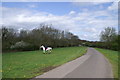
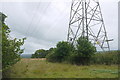
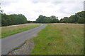
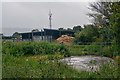
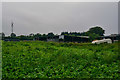


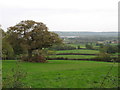
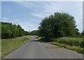
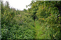
11 photos from this area
Area Information
Key information about the BS40 8YG including its size, population, and administrative classification.
- Area Type
- Postcode
- Area Size
- 92.8 hectares
- Population
- 2519
- Population Density
- 89 people/km²
House Prices in BS40 8YG
14
Properties
£671,000
Average Sold Price
£220,000
Lowest Price
£1,055,000
Highest Price
Showing 14 properties
| Address | Type | Beds | Baths | Last Sale Price | Last Sale Date | |
|---|---|---|---|---|---|---|
| Appletree Cottage, Breach Hill Common, Chew Stoke, Bristol, BS40 8YG | Detached | 4 | 3 | £830,000 | Sep 2023 | |
| Over Morton, Breach Hill Common, Chew Stoke, Bristol, BS40 8YG | house | - | - | £500,000 | Mar 2021 | |
| Yew Tree Farm, Breach Hill Common, Chew Stoke, Bristol, BS40 8YG | house | - | - | £750,000 | May 2020 | |
| Star House, Breach Hill Common, Chew Stoke, Bristol, BS40 8YG | Detached | 5 | 4 | £1,055,000 | Mar 2019 | |
| Stonehaven, Breach Hill Common, Chew Stoke, Bristol, BS40 8YG | Detached | 1 | - | £220,000 | Oct 1996 | |
| Flat, Breach Hill Farm Wilson, Breach Hill Lane, Chew Stoke, Bristol, BS40 8YG | Flat | - | - | - | - | |
| J P M E Wilson & Sons, Breach Hill Farm Wilson, Breach Hill Lane, Chew Stoke, Bristol, BS40 8YG | Office | - | - | - | - | |
| Breach Hill Farm Wilson, Breach Hill Lane, Chew Stoke, Bristol, BS40 8YG | Flat | - | - | - | - | |
| South View, The Hamlet, Chew Stoke, Bristol, BS40 8YG | Semi-detached | - | - | - | - | |
| The Mead, Breach Hill Common, Chew Stoke, Bristol, BS40 8YG | Detached | - | - | - | - |
Page 1 of 2
Energy Efficiency in BS40 8YG
Amenities
Schools
| Rank | School | Type | Entry gender | Ages |
|---|
Explore more schools in this area
Go to Schools tabDemographics
Household Size
Two person
most common
Accommodation Type
Houses
most common
Tenure
82
majority
Ethnic Group
White
most common
Religion
N/A
most common
Household Composition
N/A
most common
Age
47
median
Adults (30-64 years)
most common
Household Deprivation
N/A
with no deprivation
NS-SEC
48
in Lower managerial occupations
Explore more demographic insights in this area
Go to Demographics tabPlanning
Planning Constraints
- Flood RiskPremium
- Ramsar Wetland SitesPremium
- Area of Outstanding Natural BeautyPremium
- Protected Nature ReservePremium
- Protected WoodlandPremium