Area Overview for BS40 8EW
Photos of BS40 8EW
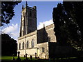
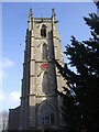
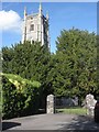
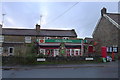
45 photos from this area
Area Information
Key information about the BS40 8EW including its size, population, and administrative classification.
- Area Type
- Postcode
- Area Size
- 1.0 hectares
- Population
- 1812
- Population Density
- 130 people/km²
House Prices in BS40 8EW
25
Properties
£351,563
Average Sold Price
£125,000
Lowest Price
£700,000
Highest Price
Showing 25 properties
| Address | Type | Beds | Baths | Last Sale Price | Last Sale Date | |
|---|---|---|---|---|---|---|
| 7 Church Road, Winford, BS40 8EW | Detached | 5 | 4 | £700,000 | Jul 2025 | |
| 12 Church Road, Winford, BS40 8EW | house | 3 | 2 | £525,000 | Dec 2023 | |
| 8 Church Road, Winford, BS40 8EW | Detached | 4 | 2 | £395,000 | Jan 2018 | |
| 27 Church Road, Winford, BS40 8EW | Detached | 4 | 2 | £377,500 | Mar 2015 | |
| 11A Church Road, Winford, BS40 8EW | Bungalow | 1 | - | £250,000 | Feb 2013 | |
| 14 Church Road, Winford, BS40 8EW | Bungalow | - | - | £240,000 | Aug 2010 | |
| The Pillar Box, Church Road, Winford, BS40 8EW | Detached | - | - | £200,000 | Jan 2005 | |
| 10 Church Road, Winford, BS40 8EW | house | - | - | £125,000 | Jul 1996 | |
| 11 Church Road, Winford, BS40 8EW | Detached | 2 | 1 | - | - | |
| 10B Church Road, Winford, BS40 8EW | Detached | 5 | 2 | - | - |
Page 1 of 3
Energy Efficiency in BS40 8EW
Amenities
Schools
| Rank | School | Type | Entry gender | Ages |
|---|
Explore more schools in this area
Go to Schools tabDemographics
Household Size
Family (3-5 people)
most common
Accommodation Type
Houses
most common
Tenure
88
majority
Ethnic Group
White
most common
Religion
N/A
most common
Household Composition
N/A
most common
Age
47
median
Adults (30-64 years)
most common
Household Deprivation
N/A
with no deprivation
NS-SEC
42
in Lower managerial occupations
Explore more demographic insights in this area
Go to Demographics tabPlanning
Planning Constraints
- Flood RiskPremium
- Ramsar Wetland SitesPremium
- Area of Outstanding Natural BeautyPremium
- Protected Nature ReservePremium
- Protected WoodlandPremium