Area Overview for BS40 8AU
Photos of BS40 8AU
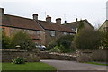
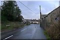
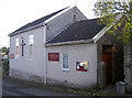
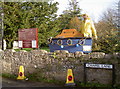


47 photos from this area
Area Information
Key information about the BS40 8AU including its size, population, and administrative classification.
- Area Type
- Postcode
- Area Size
- 2.5 hectares
- Population
- 1812
- Population Density
- 130 people/km²
House Prices in BS40 8AU
21
Properties
£302,577
Average Sold Price
£79,000
Lowest Price
£485,000
Highest Price
Showing 21 properties
| Address | Type | Beds | Baths | Last Sale Price | Last Sale Date | |
|---|---|---|---|---|---|---|
| 3 Lye Mead, Winford, BS40 8AU | Semi-detached | 3 | 2 | £390,000 | Aug 2023 | |
| 12 Lye Mead, Winford, BS40 8AU | Bungalow | - | - | £430,000 | Jun 2021 | |
| 19 Lye Mead, Winford, BS40 8AU | Bungalow | - | - | £440,000 | Mar 2021 | |
| 11 Lye Mead, Winford, BS40 8AU | Detached | 3 | 2 | £485,000 | Feb 2021 | |
| 16 Lye Mead, Winford, BS40 8AU | Semi-detached | 3 | 2 | £320,000 | Oct 2020 | |
| 17 Lye Mead, Winford, BS40 8AU | Detached | 3 | 1 | £351,500 | Jun 2018 | |
| 15 Lye Mead, Winford, BS40 8AU | Semi-detached | 3 | 1 | £308,000 | Sep 2016 | |
| 9 Lye Mead, Winford, BS40 8AU | Detached | 4 | 2 | £285,000 | Aug 2016 | |
| 14 Lye Mead, Winford, BS40 8AU | Semi-detached | 4 | 2 | £260,000 | Jul 2016 | |
| 5 Lye Mead, Winford, BS40 8AU | house | 3 | - | £244,000 | Oct 2010 |
Page 1 of 3
Energy Efficiency in BS40 8AU
Amenities
Schools
| Rank | School | Type | Entry gender | Ages |
|---|
Explore more schools in this area
Go to Schools tabDemographics
Household Size
Family (3-5 people)
most common
Accommodation Type
Houses
most common
Tenure
88
majority
Ethnic Group
White
most common
Religion
N/A
most common
Household Composition
N/A
most common
Age
47
median
Adults (30-64 years)
most common
Household Deprivation
N/A
with no deprivation
NS-SEC
42
in Lower managerial occupations
Explore more demographic insights in this area
Go to Demographics tabPlanning
Planning Constraints
- Flood RiskPremium
- Ramsar Wetland SitesPremium
- Area of Outstanding Natural BeautyPremium
- Protected Nature ReservePremium
- Protected WoodlandPremium