Area Overview for BS40 7TU
Photos of BS40 7TU
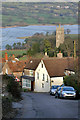
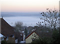
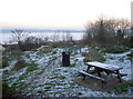
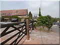
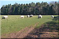
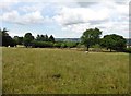
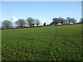
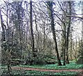
25 photos from this area
Area Information
Key information about the BS40 7TU including its size, population, and administrative classification.
- Area Type
- Postcode
- Area Size
- 7.9 hectares
- Population
- 1457
- Population Density
- 137 people/km²
House Prices in BS40 7TU
15
Properties
£407,275
Average Sold Price
£100,000
Lowest Price
£850,000
Highest Price
Showing 15 properties
| Address | Type | Beds | Baths | Last Sale Price | Last Sale Date | |
|---|---|---|---|---|---|---|
| Mendip Ridge, Ellick Road, Blagdon, BS40 7TU | house | - | - | £850,000 | Mar 2021 | |
| Quarry Farm Cottage, Ellick Road, Blagdon, BS40 7TU | house | - | - | £630,000 | Jun 2019 | |
| Heatherdown, Ellick Road, Blagdon, BS40 7TU | Detached | 5 | - | £560,000 | Jun 2017 | |
| Blackdown Cottage, Ellick Road, Blagdon, BS40 7TU | house | - | - | £610,000 | Aug 2016 | |
| Conifers, Ellick Road, Blagdon, BS40 7TU | Detached | 3 | - | £237,500 | Feb 2014 | |
| Highlands, Ellick Road, Blagdon, BS40 7TU | house | - | - | £420,000 | Feb 2007 | |
| Kia Ora, Ellick Road, Blagdon, BS40 7TU | Detached | - | - | £100,000 | Sep 2003 | |
| Fairhaven, Ellick Road, Blagdon, BS40 7TU | Detached | 5 | 3 | £330,000 | Apr 2003 | |
| Ashcroft House, Ellick Road, Blagdon, BS40 7TU | Mobile Home | 3 | 1 | £175,250 | Sep 1999 | |
| Hilltop, Ellick Road, Blagdon, BS40 7TU | Detached | 4 | 2 | £160,000 | Aug 1999 |
Page 1 of 2
Energy Efficiency in BS40 7TU
Amenities
Schools
| Rank | School | Type | Entry gender | Ages |
|---|
Explore more schools in this area
Go to Schools tabDemographics
Household Size
Two person
most common
Accommodation Type
Houses
most common
Tenure
74
majority
Ethnic Group
White
most common
Religion
N/A
most common
Household Composition
N/A
most common
Age
47
median
Adults (30-64 years)
most common
Household Deprivation
N/A
with no deprivation
NS-SEC
49
in Lower managerial occupations
Explore more demographic insights in this area
Go to Demographics tabPlanning
Planning Constraints
- Flood RiskPremium
- Ramsar Wetland SitesPremium
- Area of Outstanding Natural BeautyPremium
- Protected Nature ReservePremium
- Protected WoodlandPremium