Area Overview for BS40 6BQ
Photos of BS40 6BQ
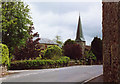
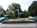
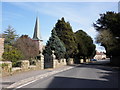
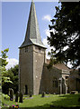
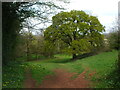
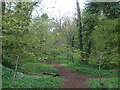
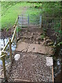
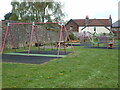
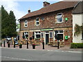
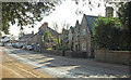
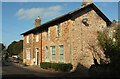
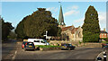
56 photos from this area
Area Information
Key information about the BS40 6BQ including its size, population, and administrative classification.
- Area Type
- Postcode
- Area Size
- 45.9 hectares
- Population
- 1484
- Population Density
- 79 people/km²
House Prices in BS40 6BQ
20
Properties
£464,872
Average Sold Price
£131,000
Lowest Price
£760,000
Highest Price
Showing 20 properties
| Address | Type | Beds | Baths | Last Sale Price | Last Sale Date | |
|---|---|---|---|---|---|---|
| 3, Chapel Buildings, West Harptree Road, East Harptree, Bristol, BS40 6BQ | house | 3 | 2 | £495,000 | Aug 2025 | |
| Stretton, West Harptree Road, East Harptree, Bristol, BS40 6BQ | Detached | 4 | 3 | £480,000 | Dec 2024 | |
| Jasper, 3 West Harptree Road, East Harptree, Bristol, BS40 6BQ | Detached | 4 | 2 | £607,720 | Apr 2024 | |
| 2, Chapel Buildings, West Harptree Road, East Harptree, Bristol, BS40 6BQ | Terraced | 3 | 2 | £525,000 | Jul 2023 | |
| Hermitage, 4 West Harptree Road, East Harptree, Bristol, BS40 6BQ | house | - | - | £635,000 | Dec 2019 | |
| The Laurels, West Harptree Road, East Harptree, Bristol, BS40 6BQ | Detached | 5 | 2 | £760,000 | Jun 2015 | |
| 1, Chapel Buildings, West Harptree Road, East Harptree, Bristol, BS40 6BQ | house | - | - | £385,000 | Nov 2011 | |
| Mendip Green, West Harptree Road, East Harptree, Bristol, BS40 6BQ | Bungalow | - | - | £200,000 | Apr 2008 | |
| Little Aden, West Harptree Road, East Harptree, Bristol, BS40 6BQ | Detached | - | - | £430,000 | Jun 2004 | |
| The Feie, 2 West Harptree Road, East Harptree, Bristol, BS40 6BQ | Land | 4 | - | £131,000 | Sep 1996 |
Page 1 of 2
Energy Efficiency in BS40 6BQ
Amenities
Schools
| Rank | School | Type | Entry gender | Ages |
|---|
Explore more schools in this area
Go to Schools tabDemographics
Household Size
Two person
most common
Accommodation Type
Houses
most common
Tenure
80
majority
Ethnic Group
White
most common
Religion
N/A
most common
Household Composition
N/A
most common
Age
47
median
Adults (30-64 years)
most common
Household Deprivation
N/A
with no deprivation
NS-SEC
48
in Lower managerial occupations
Explore more demographic insights in this area
Go to Demographics tabPlanning
Planning Constraints
- Flood RiskPremium
- Ramsar Wetland SitesPremium
- Area of Outstanding Natural BeautyPremium
- Protected Nature ReservePremium
- Protected WoodlandPremium