Area Overview for BS40 5AS
Photos of BS40 5AS
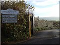
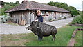
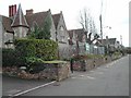
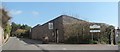
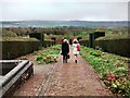
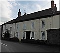
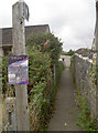
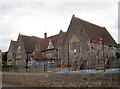
42 photos from this area
Area Information
Key information about the BS40 5AS including its size, population, and administrative classification.
- Area Type
- Postcode
- Area Size
- 3.7 hectares
- Population
- 1708
- Population Density
- 940 people/km²
House Prices in BS40 5AS
55
Properties
£403,045
Average Sold Price
£48,982
Lowest Price
£684,950
Highest Price
Showing 55 properties
| Address | Type | Beds | Baths | Last Sale Price | Last Sale Date | |
|---|---|---|---|---|---|---|
| 61 Whiting Way, Wrington, BS40 5AS | Detached | 3 | 2 | £445,000 | May 2025 | |
| 41 Whiting Way, Wrington, BS40 5AS | house | - | - | £684,950 | Oct 2022 | |
| 35 Whiting Way, Wrington, BS40 5AS | house | - | - | £499,950 | Aug 2022 | |
| 45 Whiting Way, Wrington, BS40 5AS | Semi-detached | 2 | 2 | £333,000 | Jun 2022 | |
| 11 Whiting Way, Wrington, BS40 5AS | house | - | - | £422,950 | Jun 2022 | |
| 13 Whiting Way, Wrington, BS40 5AS | house | - | - | £474,950 | May 2022 | |
| 15 Whiting Way, Wrington, BS40 5AS | house | - | - | £367,950 | Mar 2022 | |
| 53 Whiting Way, Wrington, BS40 5AS | house | - | - | £535,950 | Mar 2022 | |
| 91 Whiting Way, Wrington, BS40 5AS | Detached | 4 | 2 | £536,950 | Dec 2021 | |
| 89 Whiting Way, Wrington, BS40 5AS | house | - | - | £477,950 | Dec 2021 |
Page 1 of 6
Energy Efficiency in BS40 5AS
Amenities
Schools
| Rank | School | Type | Entry gender | Ages |
|---|
Explore more schools in this area
Go to Schools tabDemographics
Household Size
Two person
most common
Accommodation Type
Houses
most common
Tenure
75
majority
Ethnic Group
White
most common
Religion
N/A
most common
Household Composition
N/A
most common
Age
47
median
Adults (30-64 years)
most common
Household Deprivation
N/A
with no deprivation
NS-SEC
45
in Lower managerial occupations
Explore more demographic insights in this area
Go to Demographics tabPlanning
Planning Constraints
- Flood RiskPremium
- Ramsar Wetland SitesPremium
- Area of Outstanding Natural BeautyPremium
- Protected Nature ReservePremium
- Protected WoodlandPremium