Area Overview for BS4 4AJ
Photos of BS4 4AJ
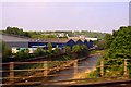
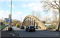
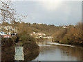
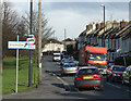


100 photos from this area
Area Information
Key information about the BS4 4AJ including its size, population, and administrative classification.
- Area Type
- Postcode
- Area Size
- 8932 m²
- Population
- 1590
- Population Density
- 3215 people/km²
House Prices in BS4 4AJ
33
Properties
£200,098
Average Sold Price
£56,510
Lowest Price
£417,500
Highest Price
Showing 33 properties
| Address | Type | Beds | Baths | Last Sale Price | Last Sale Date | |
|---|---|---|---|---|---|---|
| 49 Arlington Road, St Annes, Bristol, BS4 4AJ | Terraced | 3 | 1 | £365,000 | Dec 2025 | |
| 39 Arlington Road, St Annes, Bristol, BS4 4AJ | Terraced | 3 | 1 | £330,000 | Sep 2025 | |
| 56A Arlington Road, St Annes, Bristol, BS4 4AJ | Flat | - | - | £220,000 | May 2024 | |
| 41 Arlington Road, St Annes, Bristol, BS4 4AJ | Terraced | 3 | 1 | £417,500 | Aug 2023 | |
| 43 Arlington Road, St Annes, Bristol, BS4 4AJ | Terraced | 3 | 1 | £381,000 | Nov 2022 | |
| 56D Arlington Road, St Annes, Bristol, BS4 4AJ | Flat | - | - | £180,000 | Oct 2021 | |
| 36 Arlington Road, St Annes, Bristol, BS4 4AJ | Terraced | 3 | 1 | £230,000 | May 2020 | |
| 56C Arlington Road, St Annes, Bristol, BS4 4AJ | Flat | - | - | £179,000 | Feb 2020 | |
| 47 Arlington Road, St Annes, Bristol, BS4 4AJ | Terraced | 2 | 2 | £271,000 | Feb 2020 | |
| 56B Arlington Road, St Annes, Bristol, BS4 4AJ | Flat | 1 | 1 | £160,000 | Jan 2020 |
Page 1 of 4
Energy Efficiency in BS4 4AJ
Amenities
Schools
| Rank | School | Type | Entry gender | Ages |
|---|
Explore more schools in this area
Go to Schools tabDemographics
Household Size
Two person
most common
Accommodation Type
Houses
most common
Tenure
72
majority
Ethnic Group
White
most common
Religion
N/A
most common
Household Composition
N/A
most common
Age
47
median
Adults (30-64 years)
most common
Household Deprivation
N/A
with no deprivation
NS-SEC
44
in Lower managerial occupations
Explore more demographic insights in this area
Go to Demographics tabPlanning
Planning Constraints
- Flood RiskPremium
- Ramsar Wetland SitesPremium
- Area of Outstanding Natural BeautyPremium
- Protected Nature ReservePremium
- Protected WoodlandPremium