Area Overview for BS4 3QJ
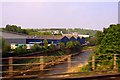
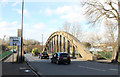
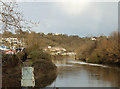
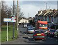
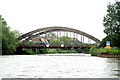
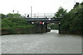
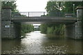
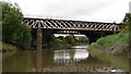
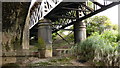
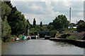
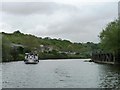
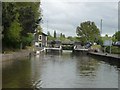
Photos of BS4 3QJ
Area Information
BS4 3QJ is a compact residential postcode in Bristol, England, encompassing a small cluster of homes within the Brislington West ward. With a population of 1,824 spread across 6,124 square metres, the area is densely populated, reflecting a tight-knit community. Situated in the BS4 postcode district, it lies within the western part of Brislington, near Arnos Vale and Kensington Park. The area’s history is rooted in medieval times, with remnants of old manor houses and a chapel linked to Henry VII. Today, it balances historical character with modern living, offering proximity to transport hubs and retail centres. Residents benefit from nearby rail stations, ferry terminals, and a range of local amenities. The median age of 47 suggests a mature population, with many households likely established in the area. While the density is high, the postcode’s small size means it is a self-contained neighbourhood, ideal for those seeking a mix of convenience and community.
- Area Type
- Postcode
- Area Size
- 6124 m²
- Population
- 1824
- Population Density
- 5411 people/km²
The property market in BS4 3QJ is characterised by a 58% home ownership rate, with houses forming the predominant accommodation type. This suggests a residential area where many properties are owner-occupied, likely reflecting a mix of established families and long-term residents. The small size of the postcode means the housing stock is limited, with little scope for new developments. Buyers should consider the immediate surroundings, as the area’s compact nature may require looking beyond BS4 3QJ for additional options. The focus on houses rather than flats indicates a preference for traditional, possibly larger properties, which could appeal to those seeking more space. However, the high population density within the postcode implies that properties may be closely spaced, potentially affecting privacy and outdoor space.
House Prices in BS4 3QJ
No properties found in this postcode.
Energy Efficiency in BS4 3QJ
Residents of BS4 3QJ enjoy a range of amenities within walking or short driving distance. Retail options include Iceland Avonmead, Lidl St, and M&S Bristol Avonmead, catering to grocery and general shopping needs. Transport links are extensive, with rail stations such as Lawrence Hill, Temple Meads, and Stapleton Road offering connections to central Bristol and beyond. Ferry terminals like Netham Lock and Temple Bridge provide access to water-based travel. The area’s proximity to Bitton and Oldland metro stations adds to its connectivity. While the data does not list parks or leisure facilities explicitly, the historical context of Brislington suggests nearby green spaces, such as St Luke’s Churchyard and remnants of medieval landscapes. This mix of retail, transport, and historical sites creates a convenient, characterful lifestyle.
Amenities
Schools
Residents of BS4 3QJ have access to two primary schools: St Anne’s Junior School and St Anne’s Infant School. Both institutions serve the local community, with the latter holding a ‘good’ Ofsted rating. This suggests a reliable foundation for early education, particularly for younger families. The presence of two primary schools within the area indicates a focus on local schooling, reducing the need for long commutes. While no secondary schools are listed in the data, the proximity to larger Bristol districts may provide additional options. The schools’ ratings and availability of both infant and junior education cater to children from early years through to primary age, making the area appealing to families prioritising accessible schooling.
| Rank | School | Type | Entry gender | Ages |
|---|
Explore more schools in this area
Go to Schools tabDemographics
The population of BS4 3QJ is predominantly adults aged 30–64, with a median age of 47. This indicates a mature, stable community, likely with a high proportion of long-term residents. Home ownership stands at 58%, suggesting a mix of owner-occupied properties and rentals, though the accommodation type is primarily houses rather than flats. The predominant ethnic group is White, reflecting the area’s demographic composition. The high population density of 297,865 people per square kilometre underscores the compact nature of the postcode, which may influence the character of daily life, with a focus on local interactions and shared spaces. While specific deprivation data is not provided, the age profile and housing stock suggest a community that is neither overwhelmingly young nor elderly, potentially offering a balanced environment for families and professionals alike.
Household Size
Accommodation Type
Tenure
Ethnic Group
Religion
Household Composition
Age
Household Deprivation
NS-SEC
Explore more demographic insights in this area
Go to Demographics tabPlanning
Planning Constraints
- Flood RiskPremium
- Ramsar Wetland SitesPremium
- Area of Outstanding Natural BeautyPremium
- Protected Nature ReservePremium
- Protected WoodlandPremium