Area Overview for BS4 1SB
Photos of BS4 1SB
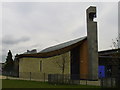
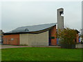
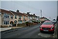
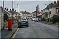

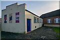
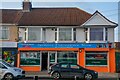
36 photos from this area
Area Information
Key information about the BS4 1SB including its size, population, and administrative classification.
- Area Type
- Postcode
- Area Size
- 6952 m²
- Population
- Not available
- Population Density
- Not available
House Prices in BS4 1SB
22
Properties
£161,169
Average Sold Price
£95,000
Lowest Price
£271,935
Highest Price
Showing 22 properties
| Address | Type | Beds | Baths | Last Sale Price | Last Sale Date | |
|---|---|---|---|---|---|---|
| 23 Carisbrooke Road, Knowle, Bristol, BS4 1SB | Semi-detached | 3 | 1 | £271,935 | Dec 2022 | |
| 31 Carisbrooke Road, Knowle, Bristol, BS4 1SB | Semi-detached | - | - | £248,000 | Jul 2021 | |
| 25 Carisbrooke Road, Knowle, Bristol, BS4 1SB | house | 3 | 1 | £175,000 | Apr 2018 | |
| 9 Carisbrooke Road, Knowle, Bristol, BS4 1SB | Semi-detached | 3 | 1 | £180,000 | Sep 2016 | |
| 33 Carisbrooke Road, Knowle, Bristol, BS4 1SB | Semi-detached | 3 | - | £125,000 | Dec 2013 | |
| 37 Carisbrooke Road, Knowle, Bristol, BS4 1SB | house | - | - | £138,750 | Aug 2007 | |
| 1 Carisbrooke Road, Knowle, Bristol, BS4 1SB | Semi-detached | - | - | £138,000 | Aug 2007 | |
| 11 Carisbrooke Road, Knowle, Bristol, BS4 1SB | Semi-detached | 2 | 2 | £115,000 | Jul 2007 | |
| 35 Carisbrooke Road, Knowle, Bristol, BS4 1SB | Semi-detached | - | - | £125,000 | May 2007 | |
| 41 Carisbrooke Road, Knowle, Bristol, BS4 1SB | Semi-detached | - | - | £95,000 | Aug 2004 |
Page 1 of 3
Energy Efficiency in BS4 1SB
Amenities
Schools
| Rank | School | Type | Entry gender | Ages |
|---|
Explore more schools in this area
Go to Schools tabDemographics
Household Size
Family (3-5 people)
most common
Accommodation Type
Houses
most common
Tenure
37
majority
Ethnic Group
White
most common
Religion
N/A
most common
Household Composition
N/A
most common
Age
47
median
Adults (30-64 years)
most common
Household Deprivation
N/A
with no deprivation
NS-SEC
14
in Lower managerial occupations
Explore more demographic insights in this area
Go to Demographics tabPlanning
Planning Constraints
- Flood RiskPremium
- Ramsar Wetland SitesPremium
- Area of Outstanding Natural BeautyPremium
- Protected Nature ReservePremium
- Protected WoodlandPremium