Area Overview for BS4 1NF
Photos of BS4 1NF
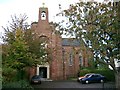
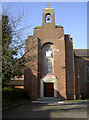
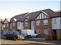
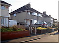
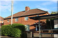

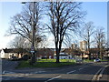

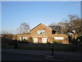
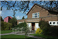
69 photos from this area
Area Information
Key information about the BS4 1NF including its size, population, and administrative classification.
- Area Type
- Postcode
- Area Size
- 7786 m²
- Population
- 1861
- Population Density
- 4565 people/km²
House Prices in BS4 1NF
26
Properties
£151,913
Average Sold Price
£36,000
Lowest Price
£287,000
Highest Price
Showing 26 properties
| Address | Type | Beds | Baths | Last Sale Price | Last Sale Date | |
|---|---|---|---|---|---|---|
| 15 Lisburn Road, Knowle, Bristol, BS4 1NF | Terraced | 3 | 1 | £285,000 | Dec 2023 | |
| 35 Lisburn Road, Knowle, Bristol, BS4 1NF | Semi-detached | 3 | 1 | £287,000 | Aug 2023 | |
| 47 Lisburn Road, Knowle, Bristol, BS4 1NF | Semi-detached | 3 | - | £195,500 | Apr 2019 | |
| 5 Lisburn Road, Knowle, Bristol, BS4 1NF | Terraced | 3 | 1 | £137,000 | Jun 2015 | |
| 7 Lisburn Road, Knowle, Bristol, BS4 1NF | Terraced | 3 | 1 | £148,630 | Apr 2015 | |
| 17 Lisburn Road, Knowle, Bristol, BS4 1NF | Semi-detached | 3 | - | £135,000 | Jan 2015 | |
| 39 Lisburn Road, Knowle, Bristol, BS4 1NF | house | - | - | £110,000 | Jun 2011 | |
| 51 Lisburn Road, Knowle, Bristol, BS4 1NF | Semi-detached | - | - | £105,000 | Jan 2005 | |
| 9 Lisburn Road, Knowle, Bristol, BS4 1NF | Terraced | - | - | £36,000 | May 2004 | |
| 33 Lisburn Road, Knowle, Bristol, BS4 1NF | house | - | - | £80,000 | Aug 2003 |
Page 1 of 3
Energy Efficiency in BS4 1NF
Amenities
Schools
| Rank | School | Type | Entry gender | Ages |
|---|
Explore more schools in this area
Go to Schools tabDemographics
Household Size
Family (3-5 people)
most common
Accommodation Type
Houses
most common
Tenure
62
majority
Ethnic Group
White
most common
Religion
N/A
most common
Household Composition
N/A
most common
Age
47
median
Adults (30-64 years)
most common
Household Deprivation
N/A
with no deprivation
NS-SEC
28
in Lower managerial occupations
Explore more demographic insights in this area
Go to Demographics tabPlanning
Planning Constraints
- Flood RiskPremium
- Ramsar Wetland SitesPremium
- Area of Outstanding Natural BeautyPremium
- Protected Nature ReservePremium
- Protected WoodlandPremium