Area Overview for BS4 1EB
Photos of BS4 1EB
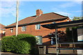

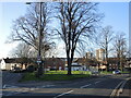
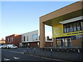
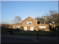
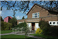
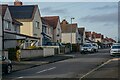
69 photos from this area
Area Information
Key information about the BS4 1EB including its size, population, and administrative classification.
- Area Type
- Postcode
- Area Size
- 5879 m²
- Population
- Not available
- Population Density
- Not available
House Prices in BS4 1EB
22
Properties
£193,596
Average Sold Price
£31,110
Lowest Price
£305,000
Highest Price
Showing 22 properties
| Address | Type | Beds | Baths | Last Sale Price | Last Sale Date | |
|---|---|---|---|---|---|---|
| 11 Newquay Road, Knowle, Bristol, BS4 1EB | Terraced | 3 | 1 | £305,000 | Mar 2024 | |
| 7 Newquay Road, Knowle, Bristol, BS4 1EB | Terraced | 3 | 1 | £290,000 | Jun 2023 | |
| 3 Newquay Road, Knowle, Bristol, BS4 1EB | Terraced | 2 | 1 | £280,000 | Jun 2021 | |
| 19 Newquay Road, Knowle, Bristol, BS4 1EB | house | 3 | 1 | £257,000 | Apr 2021 | |
| 27 Newquay Road, Knowle, Bristol, BS4 1EB | house | 3 | 1 | £195,000 | Jan 2020 | |
| 31 Newquay Road, Knowle, Bristol, BS4 1EB | Terraced | 3 | 1 | £168,000 | Nov 2016 | |
| 35 Newquay Road, Knowle, Bristol, BS4 1EB | Terraced | 3 | 1 | £180,000 | Jun 2016 | |
| 23 Newquay Road, Knowle, Bristol, BS4 1EB | Terraced | 3 | 1 | £169,950 | Feb 2016 | |
| 37 Newquay Road, Knowle, Bristol, BS4 1EB | Terraced | - | - | £139,995 | Apr 2007 | |
| 39 Newquay Road, Knowle, Bristol, BS4 1EB | Terraced | - | - | £113,500 | Aug 2005 |
Page 1 of 3
Energy Efficiency in BS4 1EB
Amenities
Schools
| Rank | School | Type | Entry gender | Ages |
|---|
Explore more schools in this area
Go to Schools tabDemographics
Household Size
Family (3-5 people)
most common
Accommodation Type
Houses
most common
Tenure
73
majority
Ethnic Group
White
most common
Religion
N/A
most common
Household Composition
N/A
most common
Age
47
median
Adults (30-64 years)
most common
Household Deprivation
N/A
with no deprivation
NS-SEC
31
in Lower managerial occupations
Explore more demographic insights in this area
Go to Demographics tabPlanning
Planning Constraints
- Flood RiskPremium
- Ramsar Wetland SitesPremium
- Area of Outstanding Natural BeautyPremium
- Protected Nature ReservePremium
- Protected WoodlandPremium