Area Overview for BS39 7XF
Photos of BS39 7XF
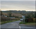


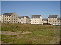
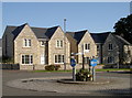
26 photos from this area
Area Information
Key information about the BS39 7XF including its size, population, and administrative classification.
- Area Type
- Postcode
- Area Size
- 6283 m²
- Population
- 2582
- Population Density
- 4118 people/km²
House Prices in BS39 7XF
20
Properties
£214,268
Average Sold Price
£95,950
Lowest Price
£307,000
Highest Price
Showing 20 properties
| Address | Type | Beds | Baths | Last Sale Price | Last Sale Date | |
|---|---|---|---|---|---|---|
| 2 Brummel Way, Paulton, Bristol, BS39 7XF | Semi-detached | 3 | 1 | £301,000 | Jan 2025 | |
| 10 Brummel Way, Paulton, Bristol, BS39 7XF | Semi-detached | 3 | 1 | £307,000 | Jun 2023 | |
| 4 Brummel Way, Paulton, Bristol, BS39 7XF | Retail | 3 | 1 | £270,000 | Dec 2022 | |
| 3 Brummel Way, Paulton, Bristol, BS39 7XF | Retail | 3 | 1 | £285,000 | May 2022 | |
| 20 Brummel Way, Paulton, Bristol, BS39 7XF | house | 3 | - | £269,000 | Jul 2020 | |
| 18 Brummel Way, Paulton, Bristol, BS39 7XF | house | - | - | £192,000 | Sep 2016 | |
| 8 Brummel Way, Paulton, Bristol, BS39 7XF | house | 3 | - | £168,000 | Mar 2011 | |
| 17 Brummel Way, Paulton, Bristol, BS39 7XF | house | - | - | £169,000 | Oct 2010 | |
| 9 Brummel Way, Paulton, Bristol, BS39 7XF | house | 3 | - | £143,000 | Dec 2005 | |
| 7 Brummel Way, Paulton, Bristol, BS39 7XF | Terraced | - | - | £157,000 | Sep 2005 |
Page 1 of 2
Energy Efficiency in BS39 7XF
Amenities
Schools
| Rank | School | Type | Entry gender | Ages |
|---|
Explore more schools in this area
Go to Schools tabDemographics
Household Size
Family (3-5 people)
most common
Accommodation Type
Houses
most common
Tenure
75
majority
Ethnic Group
White
most common
Religion
N/A
most common
Household Composition
N/A
most common
Age
47
median
Adults (30-64 years)
most common
Household Deprivation
N/A
with no deprivation
NS-SEC
33
in Lower managerial occupations
Explore more demographic insights in this area
Go to Demographics tabPlanning
Planning Constraints
- Flood RiskPremium
- Ramsar Wetland SitesPremium
- Area of Outstanding Natural BeautyPremium
- Protected Nature ReservePremium
- Protected WoodlandPremium