Area Overview for BS39 7RW
Photos of BS39 7RW
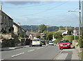
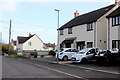
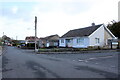
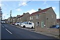
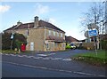
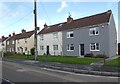
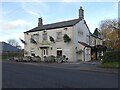
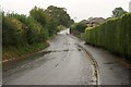
19 photos from this area
Area Information
Key information about the BS39 7RW including its size, population, and administrative classification.
- Area Type
- Postcode
- Area Size
- 2.4 hectares
- Population
- 1826
- Population Density
- 946 people/km²
House Prices in BS39 7RW
31
Properties
£220,553
Average Sold Price
£66,000
Lowest Price
£389,950
Highest Price
Showing 31 properties
| Address | Type | Beds | Baths | Last Sale Price | Last Sale Date | |
|---|---|---|---|---|---|---|
| 36 Oaklands, Paulton, Bristol, BS39 7RW | Bungalow | 4 | 2 | £389,950 | Nov 2022 | |
| 14 Oaklands, Paulton, Bristol, BS39 7RW | house | - | - | £291,000 | Aug 2021 | |
| 26 Oaklands, Paulton, Bristol, BS39 7RW | Detached | 3 | 1 | £277,500 | Dec 2020 | |
| 39 Oaklands, Paulton, Bristol, BS39 7RW | house | - | - | £257,000 | Oct 2020 | |
| 33 Oaklands, Paulton, Bristol, BS39 7RW | Bungalow | 2 | 1 | £235,000 | Mar 2020 | |
| 28 Oaklands, Paulton, Bristol, BS39 7RW | house | - | - | £229,950 | Sep 2018 | |
| 46 Oaklands, Paulton, Bristol, BS39 7RW | house | - | - | £276,000 | Nov 2017 | |
| 35 Oaklands, Paulton, Bristol, BS39 7RW | Bungalow | - | - | £227,500 | Jan 2017 | |
| 41 Oaklands, Paulton, Bristol, BS39 7RW | house | 3 | 2 | £249,950 | Dec 2016 | |
| 47 Oaklands, Paulton, Bristol, BS39 7RW | Bungalow | 2 | 2 | £175,000 | Aug 2011 |
Page 1 of 4
Energy Efficiency in BS39 7RW
Amenities
Schools
| Rank | School | Type | Entry gender | Ages |
|---|
Explore more schools in this area
Go to Schools tabDemographics
Household Size
Family (3-5 people)
most common
Accommodation Type
Houses
most common
Tenure
65
majority
Ethnic Group
White
most common
Religion
N/A
most common
Household Composition
N/A
most common
Age
47
median
Adults (30-64 years)
most common
Household Deprivation
N/A
with no deprivation
NS-SEC
24
in Lower managerial occupations
Explore more demographic insights in this area
Go to Demographics tabPlanning
Planning Constraints
- Flood RiskPremium
- Ramsar Wetland SitesPremium
- Area of Outstanding Natural BeautyPremium
- Protected Nature ReservePremium
- Protected WoodlandPremium