Area Overview for BS39 7ND
Photos of BS39 7ND
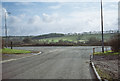
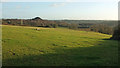
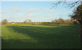
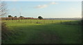

16 photos from this area
Area Information
Key information about the BS39 7ND including its size, population, and administrative classification.
- Area Type
- Postcode
- Area Size
- 15.8 hectares
- Population
- 1747
- Population Density
- 238 people/km²
House Prices in BS39 7ND
21
Properties
£196,500
Average Sold Price
£97,500
Lowest Price
£300,000
Highest Price
Showing 21 properties
| Address | Type | Beds | Baths | Last Sale Price | Last Sale Date | |
|---|---|---|---|---|---|---|
| 115 Specklemead, Paulton, Bristol, BS39 7ND | Semi-detached | 3 | 1 | £300,000 | Mar 2023 | |
| 101 Specklemead, Paulton, Bristol, BS39 7ND | Flat | - | - | £145,000 | Aug 2021 | |
| 52 Specklemead, Paulton, Bristol, BS39 7ND | Semi-detached | 3 | 1 | £227,500 | Dec 2020 | |
| 111 Specklemead, Paulton, Bristol, BS39 7ND | Semi-detached | 3 | 1 | £234,000 | Nov 2018 | |
| 109 Specklemead, Paulton, Bristol, BS39 7ND | house | - | - | £175,000 | Nov 2009 | |
| 106 Specklemead, Paulton, Bristol, BS39 7ND | Bungalow | - | - | £97,500 | Apr 2003 | |
| 51 Specklemead, Paulton, Bristol, BS39 7ND | house | 3 | 1 | - | - | |
| 52A Specklemead, Paulton, Bristol, BS39 7ND | Industrial | - | - | - | - | |
| 100 Specklemead, Paulton, Bristol, BS39 7ND | Flat | - | - | - | - | |
| 110 Specklemead, Paulton, Bristol, BS39 7ND | Terraced | - | - | - | - |
Page 1 of 3
Energy Efficiency in BS39 7ND
Amenities
Schools
| Rank | School | Type | Entry gender | Ages |
|---|
Explore more schools in this area
Go to Schools tabDemographics
Household Size
Two person
most common
Accommodation Type
Houses
most common
Tenure
80
majority
Ethnic Group
White
most common
Religion
N/A
most common
Household Composition
N/A
most common
Age
47
median
Adults (30-64 years)
most common
Household Deprivation
N/A
with no deprivation
NS-SEC
36
in Lower managerial occupations
Explore more demographic insights in this area
Go to Demographics tabPlanning
Planning Constraints
- Flood RiskPremium
- Ramsar Wetland SitesPremium
- Area of Outstanding Natural BeautyPremium
- Protected Nature ReservePremium
- Protected WoodlandPremium