Area Overview for BS39 7LH
Photos of BS39 7LH

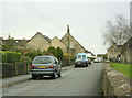
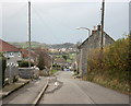
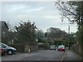
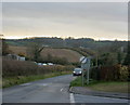


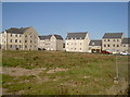
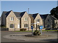
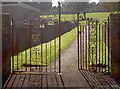
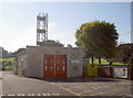
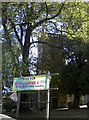
26 photos from this area
Area Information
Key information about the BS39 7LH including its size, population, and administrative classification.
- Area Type
- Postcode
- Area Size
- 1.6 hectares
- Population
- 2582
- Population Density
- 4118 people/km²
House Prices in BS39 7LH
23
Properties
£229,714
Average Sold Price
£63,000
Lowest Price
£372,000
Highest Price
Showing 23 properties
| Address | Type | Beds | Baths | Last Sale Price | Last Sale Date | |
|---|---|---|---|---|---|---|
| Southfield, Hallatrow Road, Paulton, Bristol, BS39 7LH | house | - | - | £280,000 | Sep 2021 | |
| 1, The Gables, Hallatrow Road, Paulton, Bristol, BS39 7LH | house | - | - | £265,000 | Feb 2021 | |
| Hill Crest, Hallatrow Road, Paulton, Bristol, BS39 7LH | Detached | 3 | 2 | £372,000 | Apr 2019 | |
| Greenways, 6 Hallatrow Road, Paulton, Bristol, BS39 7LH | Detached | - | - | £205,000 | Nov 2009 | |
| 4 Hallatrow Road, Paulton, Bristol, BS39 7LH | house | - | - | £180,000 | May 2009 | |
| Thornfalcon, Hallatrow Road, Paulton, Bristol, BS39 7LH | Detached | - | - | £243,000 | Jun 2002 | |
| Trebarwith, Hallatrow Road, Paulton, Bristol, BS39 7LH | house | 4 | - | £63,000 | Oct 1995 | |
| Jadian, Hallatrow Road, Paulton, Bristol, BS39 7LH | Semi-detached | 3 | 1 | - | - | |
| Ingleboro, Hallatrow Road, Paulton, Bristol, BS39 7LH | Detached | 3 | 1 | - | - | |
| Bryn Hyfrid, Hallatrow Road, Paulton, Bristol, BS39 7LH | Detached | 2 | 1 | - | - |
Page 1 of 3
Energy Efficiency in BS39 7LH
Amenities
Schools
| Rank | School | Type | Entry gender | Ages |
|---|
Explore more schools in this area
Go to Schools tabDemographics
Household Size
Family (3-5 people)
most common
Accommodation Type
Houses
most common
Tenure
75
majority
Ethnic Group
White
most common
Religion
N/A
most common
Household Composition
N/A
most common
Age
47
median
Adults (30-64 years)
most common
Household Deprivation
N/A
with no deprivation
NS-SEC
33
in Lower managerial occupations
Explore more demographic insights in this area
Go to Demographics tabPlanning
Planning Constraints
- Flood RiskPremium
- Ramsar Wetland SitesPremium
- Area of Outstanding Natural BeautyPremium
- Protected Nature ReservePremium
- Protected WoodlandPremium