Area Overview for BS39 6YZ
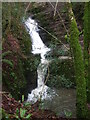
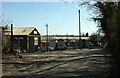
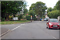
Photos of BS39 6YZ

Area Information
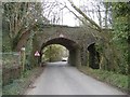
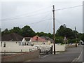
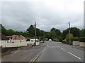
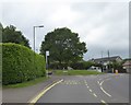
BS39 6YZ is a small residential postcode area in England, encompassing a tight-knit cluster of homes in a rural setting. With a population of 1,747 and a density of 238 people per square kilometre, it reflects a quiet, low-density living environment. The area is part of High Littleton, a village in northern Somerset, situated along the A39 and A37 roads. Historically, the village dates to Anglo-Saxon times and was shaped by coal mining in the 18th and 19th centuries. Today, it retains a rural character with rolling countryside and a ribbon-like layout along main roads. Residents benefit from proximity to Bath, Bristol, and Wells, with the village offering a mix of traditional amenities like pubs, shops, and a Church of England primary school. Daily life here is defined by a slower pace, with access to nearby services and a community rooted in local history. The area’s small size means it is ideal for those seeking a peaceful, self-contained lifestyle without sacrificing connectivity to larger urban centres.
- Area Type
- Postcode
- Area Size
- Not available
- Population
- 1747
- Population Density
- 238 people/km²
The property market in BS39 6YZ is characterised by a high rate of home ownership (80%) and a predominance of houses. This suggests a market skewed towards owner-occupied properties rather than rental units, likely reflecting the area’s rural, low-density nature. The lack of flats or apartments indicates a housing stock tailored to families or individuals seeking traditional, spacious homes. Given the small size of the postcode area, properties are likely to be in close proximity to local amenities such as the Church of England primary school and nearby retail outlets. For buyers, this means a limited selection of homes, but with the potential for long-term investment in a stable, low-risk environment. The market is unlikely to cater to short-term renters or those prioritising urban convenience, making it more suitable for those seeking a permanent, community-focused residence.
House Prices in BS39 6YZ
No properties found in this postcode.
Energy Efficiency in BS39 6YZ
The lifestyle in BS39 6YZ is shaped by its rural setting and local amenities. Within practical reach are five retail outlets, including The Radstock Co-operative Society Co and Spar, providing essential shopping and services. The village itself features a Church of England primary school, pubs, and a mix of traditional shops, fostering a community-oriented environment. Nearby, High Littleton’s rolling countryside offers opportunities for walking, cycling, or leisure activities. The presence of historical sites, such as the Holy Trinity parish church, adds cultural depth to daily life. While the area lacks large-scale entertainment or dining options, its charm lies in simplicity and accessibility. Residents benefit from a quiet, self-contained lifestyle, with amenities designed for convenience rather than urban extravagance.
Amenities
Schools
The nearest school to BS39 6YZ is Farrington Gurney Church of England Primary School, which serves children aged 4–11. While the data lists the school twice, it is the sole primary institution mentioned in the area. The absence of secondary schools or additional educational institutions means families may need to consider commuting to nearby towns for secondary education. The presence of a Church of England school suggests a community with established religious ties, though no Ofsted ratings or performance data are provided. For primary education, the school offers a local option, but parents should factor in travel time for older children. The limited range of educational facilities underscores the need to research nearby options for a comprehensive schooling experience.
| Rank | School | Type | Entry gender | Ages |
|---|
Explore more schools in this area
Go to Schools tabDemographics
The population of BS39 6YZ is predominantly adults aged 30–64, with a median age of 47. This suggests a mature, stable community with a strong presence of families and professionals. Home ownership is high, at 80%, indicating a preference for long-term residency over rental properties. The accommodation type is primarily houses, reflecting a lack of high-density housing or flats. The predominant ethnic group is White, though specific diversity metrics are not provided. The low population density of 238 people per square kilometre aligns with the rural nature of the area. This demographic profile implies a community focused on stability and family life, with limited pressure from transient populations. The age range also suggests a workforce with established careers, potentially contributing to local services and businesses.
Household Size
Accommodation Type
Tenure
Ethnic Group
Religion
Household Composition
Age
Household Deprivation
NS-SEC
Explore more demographic insights in this area
Go to Demographics tabPlanning
Planning Constraints
- Flood RiskPremium
- Ramsar Wetland SitesPremium
- Area of Outstanding Natural BeautyPremium
- Protected Nature ReservePremium
- Protected WoodlandPremium