Area Overview for BS39 6YR
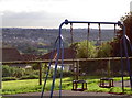
Photos of BS39 6YR
Area Information
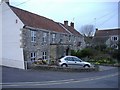
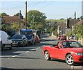
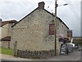
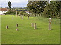
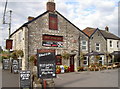
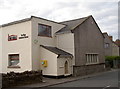
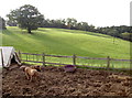
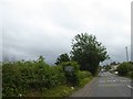
BS39 6YR is a small residential postcode area in northern Somerset, encompassing parts of the village of High Littleton. With a population of 1,344 and a density of 1,249 people per square kilometre, it is a tightly knit community set in rural, rolling countryside. The area lies along the A39 and A37 roads, placing it eight miles from Bath, ten from Bristol, and twelve from Wells. Historically a ribbon settlement developed along main roads, High Littleton retains a village character with a Church of England primary school, pubs, and local shops. Its proximity to major cities balances with a quiet, scenic setting. The area’s low flood risk and below-average crime rates, coupled with excellent broadband connectivity, make it appealing for those seeking a peaceful yet connected lifestyle. Residents benefit from a mix of historical heritage, including the 15th-century Holy Trinity church, and modern amenities like the Radstock Co-operative Society. This postcode is ideal for those prioritising safety, natural surroundings, and a close-knit community.
- Area Type
- Postcode
- Area Size
- Not available
- Population
- 1344
- Population Density
- 1249 people/km²
The property market in BS39 6YR is characterised by high home ownership (89%) and a focus on houses rather than flats or other accommodation types. This indicates a market dominated by owner-occupied homes, likely attracting buyers seeking long-term stability and family-friendly environments. The small size of the postcode area means the housing stock is limited, with properties concentrated in a rural setting. Given the high proportion of houses, the market may cater more to established families than to younger professionals or investors. Buyers should consider the area’s proximity to Bath and Bristol, which could influence property values and demand. However, the limited number of homes in the immediate vicinity may mean competition for available properties. The predominance of houses also suggests a lack of high-density development, aligning with the village’s traditional character.
House Prices in BS39 6YR
No properties found in this postcode.
Energy Efficiency in BS39 6YR
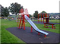
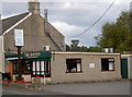
The lifestyle in BS39 6YR is shaped by its rural setting and small-scale amenities. Within practical reach are five retail venues, including Spar and the Radstock Co-operative Society, providing everyday shopping needs. The village itself features pubs, a primary school, and the Holy Trinity church, fostering a close-knit community feel. While there are no explicit mentions of parks or leisure facilities in the data, the area’s rolling countryside suggests opportunities for outdoor activities. The presence of local shops and pubs enhances daily convenience, allowing residents to meet social and practical needs without long commutes. The character of the area blends historical charm with modern essentials, offering a lifestyle that balances tranquillity with accessibility to nearby urban amenities.
Amenities
Schools
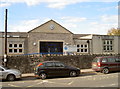
The nearest school to BS39 6YR is High Littleton CofE VC Primary School, which serves children aged 4–11. This school holds an Ofsted rating of outstanding, reflecting high standards in education and student outcomes. As the only primary school listed in the area, it is a critical resource for families with young children. The absence of secondary schools in the immediate vicinity means residents may need to consider commuting to nearby towns for secondary education. However, the outstanding rating of the primary school suggests a strong foundation for early education. The school’s presence also contributes to the area’s community feel, acting as a focal point for local families. For prospective buyers prioritising schools, the quality of this primary institution is a significant advantage.
| Rank | School | Type | Entry gender | Ages |
|---|
Explore more schools in this area
Go to Schools tabDemographics
The population of BS39 6YR has a median age of 47, with the most common age group being adults aged 30–64. This suggests a mature, stable community with a strong presence of families and long-term residents. Home ownership is high at 89%, indicating a predominance of owner-occupied properties rather than rentals. The accommodation type is primarily houses, reflecting a residential area with larger, more permanent homes. The predominant ethnic group is White, though no specific diversity data is provided. The population density of 1,249 people per square kilometre is notable for a small rural area, suggesting a compact, closely populated village environment. This density, combined with the age profile, implies a community that values stability and proximity to local amenities. The absence of specific deprivation data means the area’s quality of life is inferred from its safety, connectivity, and infrastructure.
Household Size
Accommodation Type
Tenure
Ethnic Group
Religion
Household Composition
Age
Household Deprivation
NS-SEC
Explore more demographic insights in this area
Go to Demographics tabPlanning
Planning Constraints
- Flood RiskPremium
- Ramsar Wetland SitesPremium
- Area of Outstanding Natural BeautyPremium
- Protected Nature ReservePremium
- Protected WoodlandPremium