Area Overview for BS39 6YP
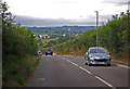
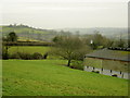
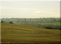
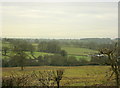
Photos of BS39 6YP
Area Information
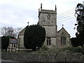
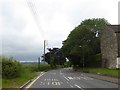
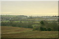
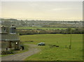
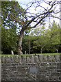
Living in BS39 6YP means settling in a small, rural cluster nestled in northern Somerset, within easy reach of Bath, Bristol, and Wells. The area is part of High Littleton, a village with a history dating back to Anglo-Saxon times, shaped by coal mining and geological significance. With a population of 1,747 and a density of 238 people per square kilometre, it retains a quiet, village character despite its proximity to major cities. The landscape is rolling countryside, with the A39 and A37 roads running through it, offering easy access to urban amenities while preserving a sense of seclusion. Daily life here is unhurried, with a focus on community and local traditions. The area’s history as a ribbon settlement along key transport routes is still visible in its layout, blending historical charm with modern convenience. For those seeking a balance between rural tranquillity and urban accessibility, BS39 6YP offers a distinctive blend of both.
- Area Type
- Postcode
- Area Size
- Not available
- Population
- 1747
- Population Density
- 238 people/km²
The property market in BS39 6YP is dominated by owner-occupied homes, with 80% of properties owned by their residents. The accommodation type is primarily houses, which suggests a focus on family-friendly, spacious living rather than apartments or terraced housing. This small area’s limited size means the housing stock is likely to be tightly clustered, with fewer options for buyers compared to larger towns. However, the high home ownership rate indicates a stable market with little turnover, which can be appealing for those seeking a long-term investment. The presence of houses also implies that the area is well-suited for families, offering more private and expansive living spaces than rental-dominated areas. Buyers should consider the limited scale of the area when exploring nearby options, as the immediate surroundings may not offer extensive variety.
House Prices in BS39 6YP
No properties found in this postcode.
Energy Efficiency in BS39 6YP
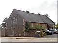
The lifestyle in BS39 6YP is defined by its rural charm and local amenities. Within practical reach are retail options such as Spar and The Radstock Co-operative Society Co, offering everyday shopping needs. The village includes pubs and a Church of England primary school, fostering a sense of community. The area’s rolling countryside and historical character provide a backdrop for leisure activities, though specific parks or recreational spaces are not detailed in the data. The presence of shops, dining venues, and educational institutions ensures convenience for daily life, while the village’s small size encourages a close-knit, familiar environment. Residents can enjoy a mix of traditional village life and easy access to nearby cities, making it suitable for those valuing both seclusion and connectivity.
Amenities
Schools
The nearest school to BS39 6YP is Farrington Gurney Church of England Primary School, which serves children aged 4–11. While the data lists this school twice, it is the only educational institution explicitly mentioned in the area. As a Church of England school, it may follow a specific educational philosophy, though its Ofsted rating is not provided. The presence of a primary school within practical reach is a key consideration for families, though the lack of secondary schools or additional educational institutions in the immediate vicinity could necessitate travel for older students. The single school listed suggests a small, tight-knit community where local education is central to daily life.
| Rank | School | Type | Entry gender | Ages |
|---|
Explore more schools in this area
Go to Schools tabDemographics
The community in BS39 6YP is predominantly middle-aged, with a median age of 47 and the majority of residents falling within the 30–64 age range. Home ownership is high, at 80%, reflecting a stable, long-term population. The accommodation type is primarily houses, indicating a mix of family homes and more spacious properties. The predominant ethnic group is White, and while specific data on diversity is not provided, the age profile suggests a mature, established community. The absence of detailed deprivation metrics means the area’s quality of life is likely shaped by its low crime rates and rural setting. With 80% of residents owning their homes, the area is less likely to experience the volatility of rental markets, offering a sense of permanence for families and individuals seeking long-term stability.
Household Size
Accommodation Type
Tenure
Ethnic Group
Religion
Household Composition
Age
Household Deprivation
NS-SEC
Explore more demographic insights in this area
Go to Demographics tabPlanning
Planning Constraints
- Flood RiskPremium
- Ramsar Wetland SitesPremium
- Area of Outstanding Natural BeautyPremium
- Protected Nature ReservePremium
- Protected WoodlandPremium