Area Overview for BS39 6HP
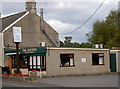
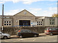
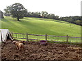
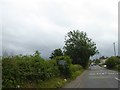
Photos of BS39 6HP
Area Information
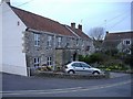
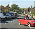
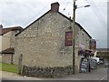
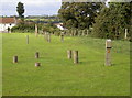
BS39 6HP is a small, densely populated postcode area in northern Somerset, England, covering 630 m² and home to 1,344 residents. Situated in the village of High Littleton, it lies along the A39 and A37 roads, just eight miles from Bath and ten from Bristol. The area’s compact size and high population density of 1,249 people per km² suggest a tight-knit community. High Littleton itself is a rural hill village with a ribbon-like layout, historically shaped by its role in coal mining and geology. The landscape blends rolling countryside with the Cam valley, offering a mix of natural beauty and practical connectivity. Residents benefit from proximity to major cities, with Bath, Bristol, and Wells within easy reach. The area’s character is defined by its heritage, including the 15th-century Holy Trinity church and historic mining roots. Daily life here is likely quiet and community-focused, with local amenities and a strong sense of place. For buyers, this postcode represents a rare blend of rural charm and accessibility to urban hubs.
- Area Type
- Postcode
- Area Size
- 630 m²
- Population
- 1344
- Population Density
- 1249 people/km²
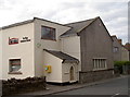
BS39 6HP is predominantly an owner-occupied area, with 89% of homes owned by residents rather than rented. The accommodation type is exclusively houses, which is unusual for a small postcode area but suggests a focus on family homes and standalone properties. This configuration may limit availability for buyers seeking flats or apartments, though the proximity to Bath, Bristol, and Wells could offer nearby alternatives. The high homeownership rate indicates a stable market with long-term residents, potentially reducing turnover and competition. However, the small size of the area (630 m²) means the housing stock is limited, requiring buyers to consider adjacent regions for more options. The presence of houses rather than rental properties also implies a lower demand for short-term lets, which could benefit those seeking long-term investment. For prospective buyers, this area may appeal to those prioritising privacy and space over urban density.
House Prices in BS39 6HP
No properties found in this postcode.
Energy Efficiency in BS39 6HP
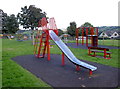
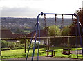
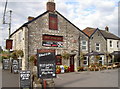
The lifestyle in BS39 6HP is shaped by its rural setting and proximity to essential amenities. Within practical reach are five retail outlets, including Spar and The Radstock Co-operative Society Co, providing access to groceries and daily essentials. The village itself features pubs, shops, and the historic Holy Trinity church, which dates back to the 15th century. These venues contribute to a community-focused environment, where local traditions and social interactions are central. The surrounding countryside offers opportunities for outdoor activities, though specific parks or recreational spaces are not detailed in the data. The presence of a primary school and nearby roads enhances convenience, allowing residents to balance rural living with urban accessibility. Overall, the area’s character is defined by its heritage, small-scale amenities, and a quiet, self-contained way of life.
Amenities
Schools
The nearest school to BS39 6HP is High Littleton CofE VC Primary School, which serves children aged 4–11. The school is a primary institution with an Ofsted rating of outstanding, reflecting high standards in education and student outcomes. As the only listed school in the data, it is the primary educational hub for local families. The absence of secondary schools nearby means students may need to commute to nearby towns like Bath or Bristol for further education. The outstanding rating suggests a strong local education system, which is a key consideration for families prioritising school quality. The single school’s prominence underscores the importance of community support for its operations, likely involving local volunteers and partnerships. For homebuyers, the presence of a high-performing primary school is a significant draw, though secondary schooling may require planning for longer-term needs.
| Rank | School | Type | Entry gender | Ages |
|---|
Explore more schools in this area
Go to Schools tabDemographics
The population of BS39 6HP has a median age of 47, with the most common age group being adults aged 30–64. This suggests a stable, mature community with a focus on long-term residency. Home ownership is high at 89%, indicating a predominance of owner-occupied properties rather than rental units. The accommodation type is primarily houses, reflecting a preference for standalone homes over flats or apartments. The predominant ethnic group is White, aligning with broader regional demographics. The age profile and high homeownership suggest a low turnover of residents, fostering a cohesive neighbourhood. With no data on deprivation, it is reasonable to infer that the area’s quality of life is supported by its low crime risk and limited environmental constraints. The demographic makeup implies a community that values stability, with families and older adults forming the core of local life.
Household Size
Accommodation Type
Tenure
Ethnic Group
Religion
Household Composition
Age
Household Deprivation
NS-SEC
Explore more demographic insights in this area
Go to Demographics tabPlanning
Planning Constraints
- Flood RiskPremium
- Ramsar Wetland SitesPremium
- Area of Outstanding Natural BeautyPremium
- Protected Nature ReservePremium
- Protected WoodlandPremium