Area Overview for BS39 6ES
Photos of BS39 6ES

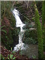
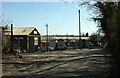
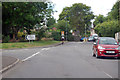
24 photos from this area
Area Information
Key information about the BS39 6ES including its size, population, and administrative classification.
- Area Type
- Postcode
- Area Size
- 1.4 hectares
- Population
- 1747
- Population Density
- 238 people/km²
House Prices in BS39 6ES
24
Properties
£228,900
Average Sold Price
£125,000
Lowest Price
£475,000
Highest Price
Showing 24 properties
| Address | Type | Beds | Baths | Last Sale Price | Last Sale Date | |
|---|---|---|---|---|---|---|
| 21 The Grove, Hallatrow, Bristol, BS39 6ES | house | 4 | - | £475,000 | Apr 2025 | |
| 12 The Grove, Hallatrow, Bristol, BS39 6ES | house | 2 | 1 | £239,000 | Mar 2022 | |
| 18 The Grove, Hallatrow, Bristol, BS39 6ES | Detached | 4 | - | £375,000 | Jul 2021 | |
| 14 The Grove, Hallatrow, Bristol, BS39 6ES | Semi-detached | 2 | 1 | £197,000 | Sep 2020 | |
| 25 The Grove, Hallatrow, Bristol, BS39 6ES | house | - | - | £404,000 | Jul 2016 | |
| 20 The Grove, Hallatrow, Bristol, BS39 6ES | Detached | - | - | £240,000 | Jan 2012 | |
| 16 The Grove, Hallatrow, Bristol, BS39 6ES | Semi-detached | 4 | 2 | £235,000 | Apr 2011 | |
| 19 The Grove, Hallatrow, Bristol, BS39 6ES | Detached | 4 | 2 | £210,000 | Apr 2003 | |
| 10 The Grove, Hallatrow, Bristol, BS39 6ES | Terraced | - | - | £188,500 | Jan 2003 | |
| 15 The Grove, Hallatrow, Bristol, BS39 6ES | Semi-detached | - | - | £172,000 | Aug 2002 |
Page 1 of 3
Energy Efficiency in BS39 6ES
Amenities
Schools
| Rank | School | Type | Entry gender | Ages |
|---|
Explore more schools in this area
Go to Schools tabDemographics
Household Size
Two person
most common
Accommodation Type
Houses
most common
Tenure
80
majority
Ethnic Group
White
most common
Religion
N/A
most common
Household Composition
N/A
most common
Age
47
median
Adults (30-64 years)
most common
Household Deprivation
N/A
with no deprivation
NS-SEC
36
in Lower managerial occupations
Explore more demographic insights in this area
Go to Demographics tabPlanning
Planning Constraints
- Flood RiskPremium
- Ramsar Wetland SitesPremium
- Area of Outstanding Natural BeautyPremium
- Protected Nature ReservePremium
- Protected WoodlandPremium